
Mynd:Locatie Straat van Otranto.PNG
Ongin hægri upploysn varð funnin.
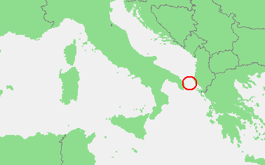
Locatie_Straat_van_Otranto.PNG (378 × 236 pixel, stødd fílu: 8 KB, MIME-slag: image/png)
| Frágreiðing | In dutch: Locatie Straat van Otranto.PNG | ||||
| Kelda | own work based on PD map | ||||
| Høvundur | edited by M.Minderhoud | ||||
| Loyvi (Endurnýtsla av hesi fílu) |
|
Søgan hjá fíluni
Trýst á dato/tíð fyri at síggja fíluna, sum hon sá út tá.
| Dagur/Tíð | Lítil mynd | Dimensjónir | Brúkari | Viðmerking | |
|---|---|---|---|---|---|
| streymur | 19. feb 2010 kl. 20:10 | | 378 × 236 (8 KB) | Telim tor | focussing on object |
| 12. sep 2006 kl. 18:21 |  | 473 × 430 (16 KB) | Michiel1972 | {{Information |Description=In dutch: {{subst:PAGENAME}} |Source= own work based on PD map |Date= |Author= edited by M.Minderhoud |Permission= {{PD-Demis}} |other_versions= }} category:Locator maps of seas |
Myndarslóðir
Hesar síður slóða til hesa mynd:
Alheims fílunýtsla
Aðrar wkiir brúka hesa fílu:
- Nýtsla á ar.wikipedia.org
- Nýtsla á ca.wikipedia.org
- Nýtsla á ckb.wikipedia.org
- Nýtsla á cy.wikipedia.org
- Nýtsla á de.wikipedia.org
- Nýtsla á en.wikipedia.org
- Nýtsla á es.wikipedia.org
- Nýtsla á fr.wikipedia.org
- Nýtsla á fy.wikipedia.org
- Nýtsla á hu.wikipedia.org
- Nýtsla á nl.wikipedia.org
- Nýtsla á pl.wikipedia.org
- Nýtsla á pl.wiktionary.org
- Nýtsla á pt.wikipedia.org
- Nýtsla á tr.wikipedia.org
- Nýtsla á vls.wikipedia.org