
Mynd:States of Germany coded.svg

Size of this PNG preview of this SVG file: 443 × 599 pixels. Aðrar upploysnir: 177 × 240 pixels | 355 × 480 pixels | 567 × 768 pixels | 757 × 1.024 pixels | 1.513 × 2.048 pixels | 592 × 801 pixels.
Upprunafíla (SVG fíle, nominelt 592 × 801 pixel, fíle stødd: 118 KB)
Samandráttur
| Frágreiðing |
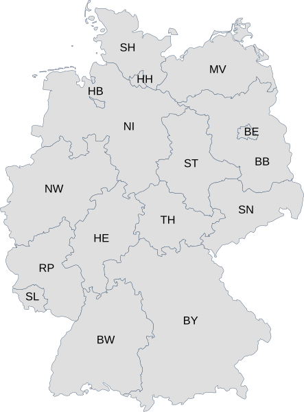
English: Map of Germany with each state labelled with its ISO 3166-2 subcode.
Deutsch: Karte von Deutschland mit den Codes der Bundesländer nach ISO 3166-2:DE |
| Dagur | |
| Kelda | File:Karte Bundesrepublik Deutschland.svg and File:Linke Landtage.svg |
| Høvundur | User:David Liuzzo and User:Voland77 |
Lisensur
This file is licensed under the Creative Commons Attribution 3.0 Unported license.
- Tú ert vælkomin til:
- at deila – at avrita, breiða út og senda verkið
- at remiksa – at tillaga ella broyta verkið
- Undir hesum treytum:
- ognan – Tú mást ognarskrivað verkið á ein slíkan hátt sum er útgreinaður av høvundanum ella lisenseigaranum (men ikki á nakran hátt ið kundi bent á at hesin hevur góðkent teg ella tína nýtslu av verkinum).
Søgan hjá fíluni
Trýst á dato/tíð fyri at síggja fíluna, sum hon sá út tá.
| Dagur/Tíð | Lítil mynd | Dimensjónir | Brúkari | Viðmerking | |
|---|---|---|---|---|---|
| streymur | 26. mar 2009 kl. 06:34 | | 592 × 801 (118 KB) | Chanheigeorge | {{Information |Description=Map of Germany with each state labelled with its ISO 3166-2 subcode. |Source=File:Karte Bundesrepublik Deutschland.svg and File:Linke Landtage.svg |Date=2009-03-26 |Author=User:David Liuzzo and User:Voland77 |Per |
Myndarslóðir
Hesar síður slóða til hesa mynd:
Alheims fílunýtsla
Aðrar wkiir brúka hesa fílu:
- Nýtsla á af.wikipedia.org
- Nýtsla á bs.wikipedia.org
- Nýtsla á ca.wikipedia.org
- Nýtsla á cs.wikipedia.org
- Nýtsla á de.wikipedia.org
- Nýtsla á en.wikipedia.org
- Nýtsla á eo.wikipedia.org
- Nýtsla á frr.wikipedia.org
- Nýtsla á id.wikipedia.org
- Nýtsla á ka.wikipedia.org
- Nýtsla á ku.wikipedia.org
- Nýtsla á no.wikipedia.org
- Nýtsla á pl.wiktionary.org
- Nýtsla á pt.wikipedia.org
- Nýtsla á roa-tara.wikipedia.org
- Nýtsla á ru.wikipedia.org
- Nýtsla á sv.wikipedia.org
- Nýtsla á tr.wikipedia.org
- Nýtsla á vi.wikipedia.org
- Nýtsla á zh-min-nan.wikipedia.org
- Nýtsla á zh.wikipedia.org