
Mynd:Europe countries map en.png
Stødd av hesi forskoðan: 737 × 600 pixels. Aðrar upploysnir: 295 × 240 pixels | 590 × 480 pixels | 944 × 768 pixels | 1.259 × 1.024 pixels | 1.475 × 1.200 pixels.
Upprunafíla (1.475 × 1.200 pixel, stødd fílu: 612 KB, MIME-slag: image/png)
Samandráttur
| Frágreiðing |
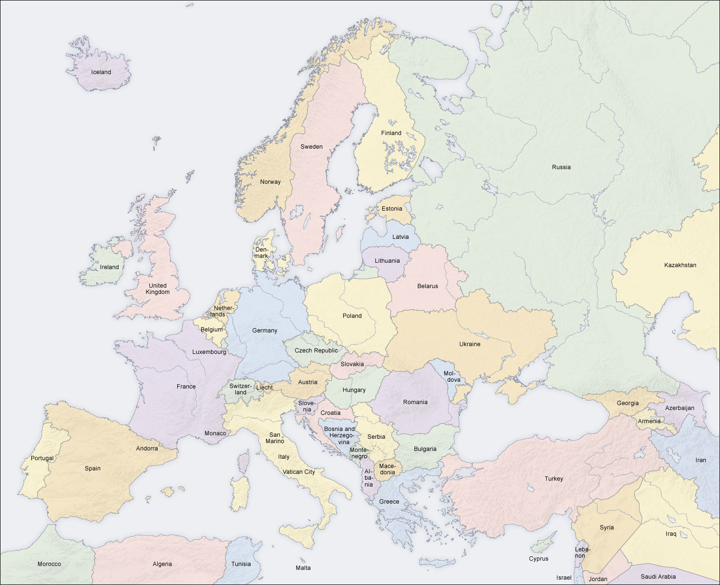
English: Map of countries in Europe |
||||||||||
| Dagur | 02.04.2006 | ||||||||||
| Kelda | Egið verk (Original text: own map, based on the Generic Mapping Tools and ETOPO2) | ||||||||||
| Høvundur | San Jose (map) | ||||||||||
| Loyvi (Endurnýtsla av hesi fílu) |
|
||||||||||
| Other versions |
Derivative works of this file: []
|


|
This map of europe image could be re-created using vector graphics as an SVG file. This has several advantages; see Commons:Media for cleanup for more information. If an SVG form of this image is available, please upload it and afterwards replace this template with
{{vector version available|new image name}}.
It is recommended to name the SVG file “Europe countries map en.svg”—then the template Vector version available (or Vva) does not need the new image name parameter. |
See also
_en.png)
.png)
.jpg)
| Annotations | This image is annotated: View the annotations at Commons |
Søgan hjá fíluni
Trýst á dato/tíð fyri at síggja fíluna, sum hon sá út tá.
| Dagur/Tíð | Lítil mynd | Dimensjónir | Brúkari | Viðmerking | |
|---|---|---|---|---|---|
| streymur | 3. mar 2018 kl. 14:49 | | 1.475 × 1.200 (612 KB) | Wiz9999 | Reverted to version as of 08:37, 12 June 2008 (UTC) - Please use File:Europe countries map en 2.png to show disputed land. |
| 22. nov 2017 kl. 17:07 |  | 1.475 × 1.200 (1,32 MB) | Мечников | update | |
| 12. jun 2008 kl. 08:37 |  | 1.475 × 1.200 (612 KB) | San Jose | update | |
| 5. jun 2006 kl. 11:52 |  | 1.475 × 1.200 (658 KB) | San Jose | updated and corrected | |
| 4. jun 2006 kl. 14:58 |  | 1.475 × 1.200 (611 KB) | Roke~commonswiki | montenegro independent now | |
| 2. apr 2006 kl. 11:14 |  | 1.475 × 1.200 (661 KB) | San Jose | Upload |
Myndarslóðir
Ongar síður slóða til hesa myndina.
Alheims fílunýtsla
Aðrar wkiir brúka hesa fílu:
- Nýtsla á da.wikipedia.org
- Nýtsla á de.wikipedia.org
- Nýtsla á en.wikipedia.org
- Nýtsla á haw.wikipedia.org
- Nýtsla á he.wikipedia.org
- Nýtsla á hyw.wikipedia.org
- Nýtsla á ilo.wikipedia.org
- Nýtsla á nl.wikinews.org
- Nýtsla á pag.wikipedia.org
- Nýtsla á roa-rup.wikipedia.org
- Nýtsla á ro.wikipedia.org
- Nýtsla á simple.wiktionary.org
- Nýtsla á su.wikipedia.org
- Nýtsla á ta.wikipedia.org
- Nýtsla á uk.wikipedia.org