
Mynd:Nouvelle-Calédonie collectivity location map.svg

Size of this PNG preview of this SVG file: 800 × 295 pixels. Aðrar upploysnir: 320 × 118 pixels | 640 × 236 pixels | 1.024 × 377 pixels | 1.280 × 471 pixels | 2.560 × 942 pixels | 1.608 × 592 pixels.
Upprunafíla (SVG fíle, nominelt 1.608 × 592 pixel, fíle stødd: 207 KB)
Samandráttur
| Camera location | | View this and other nearby images on: OpenStreetMap |
|---|
| Frágreiðing |
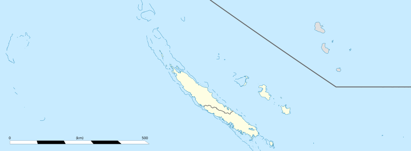
English: Blank administrative map of the territorial collectivity of New Caledonia, France, for geo-location purpose.
This is a general map allowing to geo-locate remote islands. For maps centered on the main islands, see below. Français : Carte administrative vierge de la collectivité territoriale de Nouvelle-Calédonie, France, destinée à la géolocalisation. Ceci est une carte générale permettant la géolocalisation des îles isolées. Pour des cartes centrées sur les îles principales, voir plus bas. Equirectangular projection, WGS84 datum
Geographic limits of the map:
|
||
| Dagur | |||
| Kelda |
Egið verk
|
||
| Høvundur | Eric Gaba (Sting - fr:Sting) | ||
| Loyvi (Endurnýtsla av hesi fílu) |
|
||
| Other versions |
|


Lisensur
I, the copyright holder of this work, hereby publish it under the following licenses:
Henda fíla er gjørd atkomulig undir Creative Commons Navngev-Deil á sama hátt 3.0 Unported loyvinum.
- Tú ert vælkomin til:
- at deila – at avrita, breiða út og senda verkið
- at remiksa – at tillaga ella broyta verkið
- Undir hesum treytum:
- ognan – Tú mást ognarskrivað verkið á ein slíkan hátt sum er útgreinaður av høvundanum ella lisenseigaranum (men ikki á nakran hátt ið kundi bent á at hesin hevur góðkent teg ella tína nýtslu av verkinum).
- deil undir somu treytum – Um tú broytir, evnar til ella byggir víðari á hetta verk, so kanst tú bert útgeva verkið undir somu ella líkandi lisensi sum hesin.

|
Loyvi verður givi at avrita, bera út og/ella broyta hetta skjal undir treytunum hjá GNU Free Documentation License, versión 1.2 ella einhvør seinni versjón ið er útgivin av Free Software Foundation; uttan nakað óbroytiligt brot, uttan forsíðutekst og uttan baksíðutekst. Eitt avrit av loyvinum er tikið við í brotinum ið nevnist GNU Free Documentation License. |
Tú kanst velja tann lisens ið tú ynskir.
Søgan hjá fíluni
Trýst á dato/tíð fyri at síggja fíluna, sum hon sá út tá.
| Dagur/Tíð | Lítil mynd | Dimensjónir | Brúkari | Viðmerking | |
|---|---|---|---|---|---|
| streymur | 4. aug 2013 kl. 15:26 | 1.608 × 592 (207 KB) | Szczureq | removed non-existent Sandy Island | |
| 21. jan 2009 kl. 03:07 | 1.608 × 592 (177 KB) | Sting | == Summary == {{Location|20|22|30|S|165|10|30|E|scale:5000000}} <br/> {{Information |Description={{en|Blank administrative map of the territorial collectivity of New Caledonia, France, for |
Myndarslóðir
Ongar síður slóða til hesa myndina.
Alheims fílunýtsla
Aðrar wkiir brúka hesa fílu:
- Nýtsla á ba.wikipedia.org
- Nýtsla á bn.wikipedia.org
- Nýtsla á de.wikipedia.org
- Nýtsla á fr.wikipedia.org
- Aquarium des lagons
- Îles Chesterfield
- Province Nord (Nouvelle-Calédonie)
- Grande Terre (Nouvelle-Calédonie)
- Nouvelle-Calédonie
- Centre culturel Tjibaou
- Communauté du Pacifique
- Aéroport international de Nouméa-La Tontouta
- Province Sud (Nouvelle-Calédonie)
- Aéroport de Magenta
- Place des Cocotiers
- Géographie de la Nouvelle-Calédonie
- Fayaoué
- Prise d'otages d'Ouvéa
- Hippodrome Henri-Milliard
- Lekine
- Île Hunter (Pacifique Sud)
- Île Matthew
- Île Walpole (Nouvelle-Calédonie)
- Hôpital Gaston-Bourret
- Hôpital de Magenta
- Centre hospitalier territorial Gaston-Bourret de Nouvelle-Calédonie
- Centre hospitalier spécialisé Albert-Bousquet
- Polyclinique de l'Anse Vata
- Clinique Magnin
- Clinique de la Baie des Citrons
- Modèle:Infobox Tribu de Nouvelle-Calédonie
- Barrage de Yaté
- Cœur de Voh
- Expédition d'Entrecasteaux
- Université de la Nouvelle-Calédonie
- Fort Teremba
- Parc zoologique et forestier Michel-Corbasson
- Foire de Bourail
- Plage de Poé
- Modèle:Géolocalisation/Nouvelle-Calédonie
- Stade Numa-Daly
- Wikipédia:Atelier graphique/Cartes/Archives/Demandes mises en sommeil
- Récifs d'Entrecasteaux
- Gossanah
Vís meiri globala nýtslu av hesi fílu.