
Mynd:Map spb 1744 high.jpg
Stødd av hesi forskoðan: 800 × 552 pixels. Aðrar upploysnir: 320 × 221 pixels | 640 × 441 pixels | 1.024 × 706 pixels | 1.280 × 883 pixels | 2.100 × 1.448 pixels.
Upprunafíla (2.100 × 1.448 pixel, stødd fílu: 741 KB, MIME-slag: image/jpeg)
Samandráttur
| Frágreiðing |
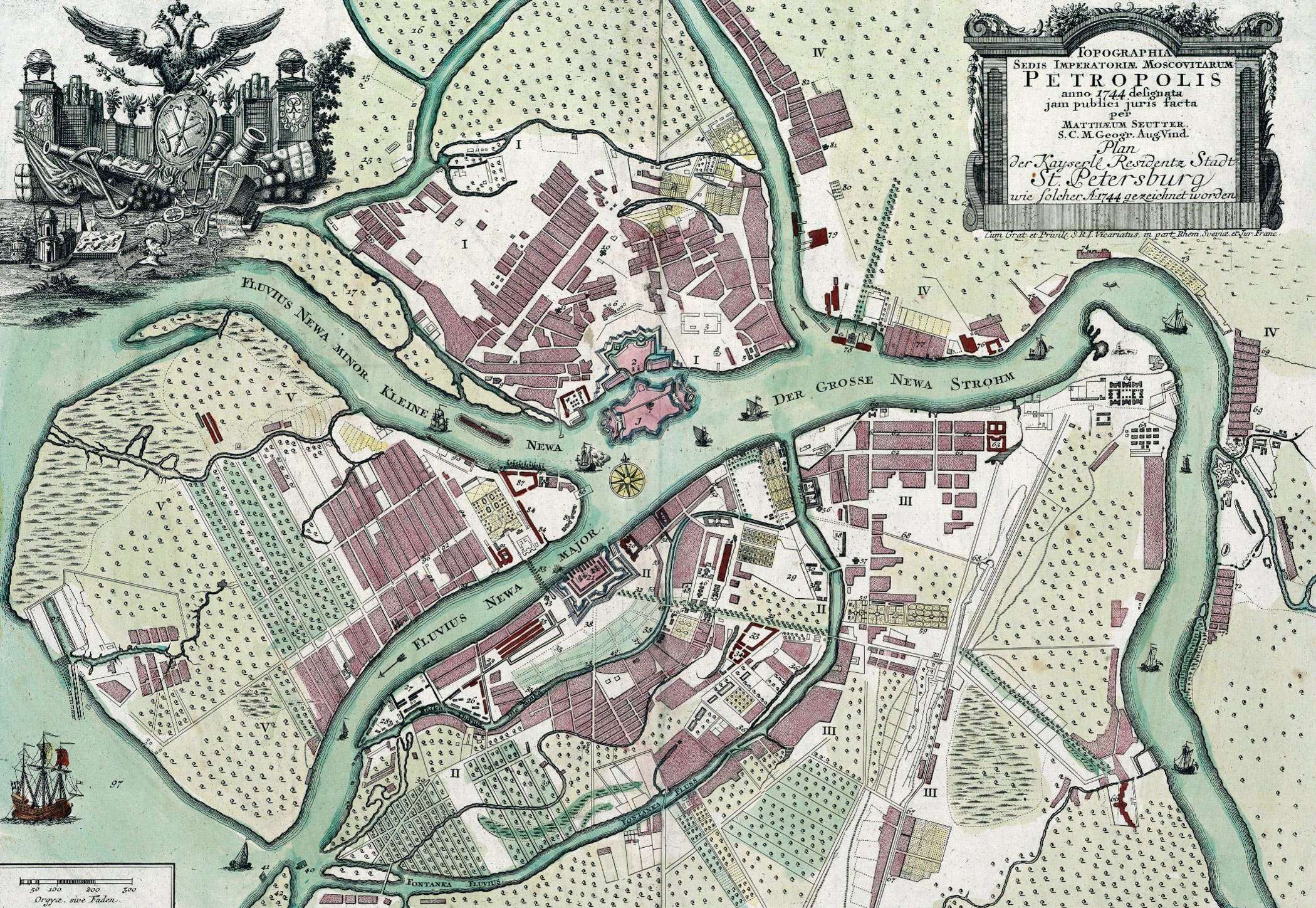
English: Map of St. Petersburg compiled, in 1744, by Matthias Souter Русский: Карта Санкт-Петербурга составленная в 1744 г. Маттиас Сойтер |
| Dagur | |
| Kelda | http://www.spbin.ru/maps/map_stoyter_1744.htm |
| Høvundur | Маттиас Сойтер |
Lisensur
|
This work is in the public domain in its country of origin and other countries and areas where the copyright term is the author's life plus 100 years or fewer. | |
| This file has been identified as being free of known restrictions under copyright law, including all related and neighboring rights. | |
Søgan hjá fíluni
Trýst á dato/tíð fyri at síggja fíluna, sum hon sá út tá.
| Dagur/Tíð | Lítil mynd | Dimensjónir | Brúkari | Viðmerking | |
|---|---|---|---|---|---|
| streymur | 25. mai 2010 kl. 07:47 | | 2.100 × 1.448 (741 KB) | Peterburg23 | == Summary == {{Information |Description=Карта Санкт-Петербурга составленная в 1744 г. Маттиас Сойтер |Source=http://www.spbin.ru/maps/map_stoyter_1744.htm |Date=1744 |Author=Маттиас Сойтер |Perm |
Myndarslóðir
Ongar síður slóða til hesa myndina.
Alheims fílunýtsla
Aðrar wkiir brúka hesa fílu:
- Nýtsla á azb.wikipedia.org
- Nýtsla á en.wikipedia.org
- Nýtsla á gl.wikipedia.org
- Nýtsla á id.wikipedia.org
- Nýtsla á io.wikipedia.org
- Nýtsla á mt.wikipedia.org
- Nýtsla á pl.wikipedia.org
- Nýtsla á sl.wikipedia.org
- Nýtsla á ta.wikipedia.org
- Nýtsla á te.wikipedia.org
- Nýtsla á zh.wikipedia.org