
Mynd:Map of federal subjects of Russia (2022), disputed Crimea and Donbass.svg

Size of this PNG preview of this SVG file: 512 × 282 pixels. Aðrar upploysnir: 320 × 176 pixels | 640 × 353 pixels | 1.024 × 564 pixels | 1.280 × 705 pixels | 2.560 × 1.410 pixels.
Upprunafíla (SVG fíle, nominelt 512 × 282 pixel, fíle stødd: 827 KB)
,_disputed_Crimea_and_Donbass.svg)

|
The boundaries on this map show the de facto situation. This is just one of several different views on the subject (see COM:NPOV). |
Samandráttur
| Frágreiðing |
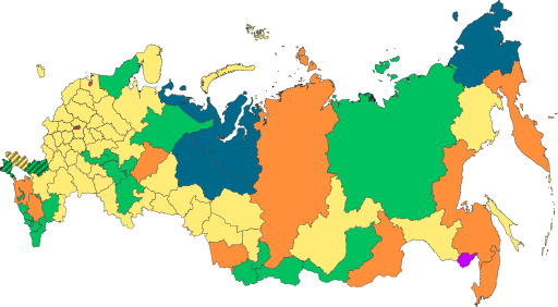
English: Copy of File:Map of federal subjects of Russia (2022).svg with disputed annexed Ukrainian territories indicated with diagonal stripes |
| Dagur | |
| Kelda |
This file was derived from: Map of federal subjects of Russia 2014, disputed Crimea.svg |
| Høvundur | Mzajac, Ltbubbas |
.svg)
Lisensur
| This map is ineligible for copyright and therefore in the public domain, because it consists entirely of information that is common property and contains no original authorship. For more information, see Commons:Threshold of originality § Maps.
|
Søgan hjá fíluni
Trýst á dato/tíð fyri at síggja fíluna, sum hon sá út tá.
| Dagur/Tíð | Lítil mynd | Dimensjónir | Brúkari | Viðmerking | |
|---|---|---|---|---|---|
| streymur | 4. okt 2022 kl. 19:48 | | 512 × 282 (827 KB) | Techso01 | Uploaded a work by Mzajac, Ltbubbas from {{derived from|Map of federal subjects of Russia (2014), disputed Crimea.svg}} with UploadWizard |
Myndarslóðir
Ongar síður slóða til hesa myndina.
Alheims fílunýtsla
Aðrar wkiir brúka hesa fílu:
- Nýtsla á ab.wikipedia.org
- Nýtsla á ar.wikipedia.org
- Nýtsla á ast.wikipedia.org
- Nýtsla á be.wikipedia.org
- Nýtsla á cs.wikipedia.org
- Nýtsla á de.wikipedia.org
- Nýtsla á en.wikipedia.org
- Nýtsla á es.wikipedia.org
- Nýtsla á fa.wikipedia.org
- Nýtsla á fr.wikipedia.org
- Nýtsla á is.wikipedia.org
- Nýtsla á it.wikipedia.org
- Nýtsla á ja.wikipedia.org
- Nýtsla á ko.wikipedia.org
- Nýtsla á la.wikipedia.org
- Nýtsla á lez.wikipedia.org
- Nýtsla á lld.wikipedia.org
- Nýtsla á lt.wikipedia.org
- Nýtsla á lv.wikipedia.org
- Nýtsla á mi.wikipedia.org
- Nýtsla á oc.wikipedia.org
- Nýtsla á pt.wikipedia.org
- Nýtsla á ru.wikipedia.org
- Nýtsla á sl.wikipedia.org
- Nýtsla á sr.wikipedia.org
- Nýtsla á th.wikipedia.org
- Nýtsla á tly.wikipedia.org
- Nýtsla á tum.wikipedia.org
- Nýtsla á uk.wikipedia.org
- Nýtsla á uz.wikipedia.org
- Nýtsla á vi.wikipedia.org
- Nýtsla á vls.wikipedia.org
Vís meiri globala nýtslu av hesi fílu.
,_disputed_Crimea_and_Donbass.svg)
,_disputed_Crimea_and_Donbass.svg)