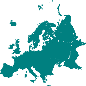
Mynd:Cartography of Europe.svg

Size of this PNG preview of this SVG file: 350 × 351 pixels. Aðrar upploysnir: 239 × 240 pixels | 479 × 480 pixels | 766 × 768 pixels | 1.021 × 1.024 pixels | 2.042 × 2.048 pixels.
Upprunafíla (SVG fíle, nominelt 350 × 351 pixel, fíle stødd: 31 KB)
Søgan hjá fíluni
Trýst á dato/tíð fyri at síggja fíluna, sum hon sá út tá.
| Dagur/Tíð | Lítil mynd | Dimensjónir | Brúkari | Viðmerking | |
|---|---|---|---|---|---|
| streymur | 24. mar 2021 kl. 13:59 |  | 350 × 351 (31 KB) | PastelKos | Reverted to version as of 23:02, 23 May 2020 (UTC) so as to match with the other "cartography of ___" maps |
| 21. jan 2021 kl. 12:53 |  | 350 × 351 (31 KB) | Est. 2021 | Reverted to version as of 15:33, 6 January 2010 (UTC) | |
| 23. mai 2020 kl. 23:02 |  | 350 × 351 (31 KB) | Sittaco | Reverted to version as of 00:20, 12 September 2009 (UTC) | |
| 6. jan 2010 kl. 15:33 |  | 350 × 351 (31 KB) | Hayden120 | Changed colour to blue; a colour commonly associated with Europe. It also matches the style of 'Portal:Europe' on the English Wikipedia. | |
| 12. sep 2009 kl. 00:20 |  | 350 × 351 (31 KB) | TownDown | {{Information |Description={{en|1=x}} |Source=Own work by uploader |Author=TownDown |Date= |Permission= |other_versions= }} Category:svg |
Myndarslóðir
Ongar síður slóða til hesa myndina.
Alheims fílunýtsla
Aðrar wkiir brúka hesa fílu:
- Nýtsla á ar.wikipedia.org
- بوابة:ألمانيا
- بوابة:ألمانيا/بوابات شقيقة
- بوابة:إيطاليا
- بوابة:إيطاليا/بوابات شقيقة
- بوابة:فرنسا
- بوابة:إسبانيا
- بوابة:النمسا
- بوابة:البرتغال
- بوابة:سويسرا
- بوابة:كرواتيا
- بوابة:كرواتيا/شقيقة
- بوابة:بلغاريا
- بوابة:بلغاريا/شقيقة
- بوابة:المجر
- بوابة:المجر/شقيقة
- ويكيبيديا:مشروع ويكي الاتحاد الأوروبي
- بوابة:النمسا/شقيقة
- بوابة:اليونان
- بوابة:اليونان/شقيقة
- بوابة:الدنمارك/بوابات شقيقة
- بوابة:الدنمارك
- بوابة:رومانيا/بوابات شقيقة
- بوابة:رومانيا
- بوابة:ألبانيا/بوابات شقيقة
- بوابة:ألبانيا
- بوابة:مقدونيا الشمالية/بوابات شقيقة
- بوابة:مقدونيا الشمالية
- بوابة:صربيا/بوابات شقيقة
- بوابة:صربيا
- بوابة:البلقان/بوابات شقيقة
- بوابة:البلقان
- بوابة:كوسوفو/بوابات شقيقة
- بوابة:الجبل الأسود/بوابات شقيقة
- بوابة:الجبل الأسود
- بوابة:كوسوفو
- بوابة:البرتغال/بوابات شقيقة
- بوابة:المتوسط
- بوابة:المتوسط/بوابات شقيقة
- بوابة:ألبانيا/شقيقة
- بوابة:إسبانيا/بوابات شقيقة
- بوابة:سويسرا/بوابات أخرى
- بوابة:فرنسا/بوابات شقيقة
- بوابة:دورتموند
- بوابة:دورتموند/بوابات شقيقة
- Nýtsla á bn.wikipedia.org
- Nýtsla á cs.wikipedia.org
- Nýtsla á de.wikipedia.org
- Nýtsla á el.wikipedia.org
Vís meiri globala nýtslu av hesi fílu.


