
Mynd:Map-position-runavikar-kommuna-2009.png

Stødd av hesi forskoðan: 450 × 600 pixels. Aðrar upploysnir: 180 × 240 pixels | 600 × 800 pixels.
Upprunafíla (600 × 800 pixel, stødd fílu: 33 KB, MIME-slag: image/png)
Samandráttur
| Frágreiðing |
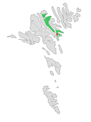
English: Location of Runavíkar kommuna at the Faroe Islands, with borders as of 2009.
Norsk bokmål: Plassering av Runavíkar kommuna på Færøyene, med grensene av 2009. |
| Dagur | |
| Kelda | Own work, based on free image by Arne List |
| Høvundur | Erik Fløan |
| Other versions | Original (2005 edition) |
Lisensur
| I, the copyright holder of this work, release this work into the public domain. This applies worldwide. In some countries this may not be legally possible; if so: I grant anyone the right to use this work for any purpose, without any conditions, unless such conditions are required by law. |
Søgan hjá fíluni
Trýst á dato/tíð fyri at síggja fíluna, sum hon sá út tá.
| Dagur/Tíð | Lítil mynd | Dimensjónir | Brúkari | Viðmerking | |
|---|---|---|---|---|---|
| streymur | 2. jan 2009 kl. 21:12 | | 600 × 800 (33 KB) | Efloean | {{Information |Description={{en|1=Location of Runavíkar kommuna at the Faroe Islands, with borders as of 2009.}} {{no|1=Plassering av Runavíkar kommuna på Færøyene, med grensene av 2009.}} |Source=Own work, based on free image by [[user:Arne List|Arn |
Myndarslóðir
Hesar síður slóða til hesa mynd:
Alheims fílunýtsla
Aðrar wkiir brúka hesa fílu:
- Nýtsla á ca.wikipedia.org
- Nýtsla á da.wikipedia.org
- Nýtsla á el.wikipedia.org
- Nýtsla á en.wikipedia.org
- Nýtsla á es.wikipedia.org
- Nýtsla á eu.wikipedia.org
- Nýtsla á fr.wikipedia.org
- Nýtsla á gv.wikipedia.org
- Nýtsla á hu.wikipedia.org
- Nýtsla á it.wikipedia.org
- Nýtsla á no.wikipedia.org
- Nýtsla á pl.wikipedia.org
- Nýtsla á ro.wikipedia.org
- Nýtsla á ru.wikipedia.org
- Nýtsla á sco.wikipedia.org
- Nýtsla á sv.wikipedia.org
- Nýtsla á tr.wikipedia.org
- Nýtsla á www.wikidata.org
- Nýtsla á zh.wikipedia.org