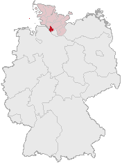
Mynd:Lage des Kreises Pinneberg in Deutschland.png
Lage_des_Kreises_Pinneberg_in_Deutschland.png (176 × 234 pixel, stødd fílu: 4 KB, MIME-slag: image/png)
Søgan hjá fíluni
Trýst á dato/tíð fyri at síggja fíluna, sum hon sá út tá.
| Dagur/Tíð | Lítil mynd | Dimensjónir | Brúkari | Viðmerking | |
|---|---|---|---|---|---|
| streymur | 5. apr 2007 kl. 12:21 |  | 176 × 234 (4 KB) | Ditschi | transparent |
| 3. mar 2006 kl. 09:19 |  | 176 × 234 (4 KB) | Rauenstein | Karte erstellt auf der Grundlage der opengeodb.de-Umrisse - GNU-FDL Geograv 00:54, 31. Dez 2004 {{Bild-GFDL}} Category:Maps of Germany |
Myndarslóðir
Hesar síður slóða til hesa mynd:
Alheims fílunýtsla
Aðrar wkiir brúka hesa fílu:
- Nýtsla á ace.wikipedia.org
- Nýtsla á am.wikipedia.org
- Nýtsla á ang.wikipedia.org
- Nýtsla á arc.wikipedia.org
- Nýtsla á av.wikipedia.org
- Nýtsla á ay.wikipedia.org
- Nýtsla á bcl.wikipedia.org
- Nýtsla á bi.wikipedia.org
- Nýtsla á bm.wikipedia.org
- Nýtsla á bpy.wikipedia.org
- Nýtsla á bxr.wikipedia.org
- Nýtsla á cbk-zam.wikipedia.org
- Nýtsla á ceb.wikipedia.org
- Nýtsla á ch.wikipedia.org
- Nýtsla á cr.wikipedia.org
- Nýtsla á cs.wikipedia.org
- Nýtsla á cu.wikipedia.org
- Nýtsla á cv.wikipedia.org
- Nýtsla á cy.wikipedia.org
- Nýtsla á dsb.wikipedia.org
- Nýtsla á dv.wikipedia.org
- Nýtsla á dz.wikipedia.org
- Nýtsla á eml.wikipedia.org
- Nýtsla á eo.wikipedia.org
- Nýtsla á es.wikipedia.org
- Nýtsla á ext.wikipedia.org
- Nýtsla á ff.wikipedia.org
- Nýtsla á fiu-vro.wikipedia.org
- Nýtsla á fj.wikipedia.org
- Nýtsla á frp.wikipedia.org
- Nýtsla á frr.wikipedia.org
- Nýtsla á fr.wikipedia.org
- Nýtsla á fur.wikipedia.org
- Nýtsla á fy.wikipedia.org
- Nýtsla á gag.wikipedia.org
- Nýtsla á gn.wikipedia.org
- Nýtsla á got.wikipedia.org
- Nýtsla á hak.wikipedia.org
- Nýtsla á haw.wikipedia.org
- Nýtsla á hif.wikipedia.org
- Nýtsla á hi.wikipedia.org
- Nýtsla á hr.wikipedia.org
- Nýtsla á ht.wikipedia.org
- Nýtsla á hy.wikipedia.org
- Nýtsla á id.wikipedia.org
- Nýtsla á ie.wikipedia.org
- Nýtsla á incubator.wikimedia.org
Vís meiri globala nýtslu av hesi fílu.

