
Mynd:Galapagos Islands topographic map-de.svg

Size of this PNG preview of this SVG file: 600 × 600 pixels. Aðrar upploysnir: 240 × 240 pixels | 480 × 480 pixels | 768 × 768 pixels | 1.024 × 1.024 pixels | 2.048 × 2.048 pixels | 2.160 × 2.160 pixels.
Upprunafíla (SVG fíle, nominelt 2.160 × 2.160 pixel, fíle stødd: 2,62 MB)
Samandráttur
| Object location | | View this and other nearby images on: OpenStreetMap |
|---|
| Frágreiðing |
|
| Dagur | |
| Kelda |
Own work
|
| Høvundur | Eric Gaba (Sting - fr:Sting), translated by NordNordWest |
| Loyvi (Endurnýtsla av hesi fílu) |
GFDL / Attribution and Share-Alike required |
| Other versions |
[]
|

.png)


|
This SVG file contains embedded text that can be translated into your language, using any capable SVG editor, text editor or the SVG Translate tool. For more information see: About translating SVG files. |
Lisensur
I, the copyright holder of this work, hereby publish it under the following licenses:

|
Loyvi verður givi at avrita, bera út og/ella broyta hetta skjal undir treytunum hjá GNU Free Documentation License, versión 1.2 ella einhvør seinni versjón ið er útgivin av Free Software Foundation; uttan nakað óbroytiligt brot, uttan forsíðutekst og uttan baksíðutekst. Eitt avrit av loyvinum er tikið við í brotinum ið nevnist GNU Free Documentation License. |
This file is licensed under the Creative Commons Attribution-Share Alike 4.0 International, 3.0 Unported, 2.5 Generic, 2.0 Generic and 1.0 Generic license.
- Tú ert vælkomin til:
- at deila – at avrita, breiða út og senda verkið
- at remiksa – at tillaga ella broyta verkið
- Undir hesum treytum:
- ognan – Tú mást ognarskrivað verkið á ein slíkan hátt sum er útgreinaður av høvundanum ella lisenseigaranum (men ikki á nakran hátt ið kundi bent á at hesin hevur góðkent teg ella tína nýtslu av verkinum).
- deil undir somu treytum – Um tú broytir, evnar til ella byggir víðari á hetta verk, so kanst tú bert útgeva verkið undir somu ella líkandi lisensi sum hesin.
Tú kanst velja tann lisens ið tú ynskir.
Søgan hjá fíluni
Trýst á dato/tíð fyri at síggja fíluna, sum hon sá út tá.
| Dagur/Tíð | Lítil mynd | Dimensjónir | Brúkari | Viðmerking | |
|---|---|---|---|---|---|
| streymur | 11. jun 2016 kl. 17:36 | | 2.160 × 2.160 (2,62 MB) | NordNordWest | Bahia Tortuga corrected |
| 3. nov 2008 kl. 19:33 |  | 2.160 × 2.160 (2,62 MB) | NordNordWest | corrected | |
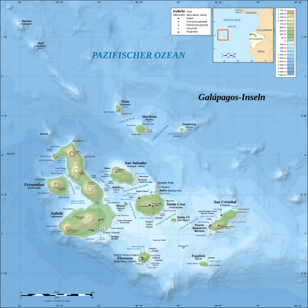
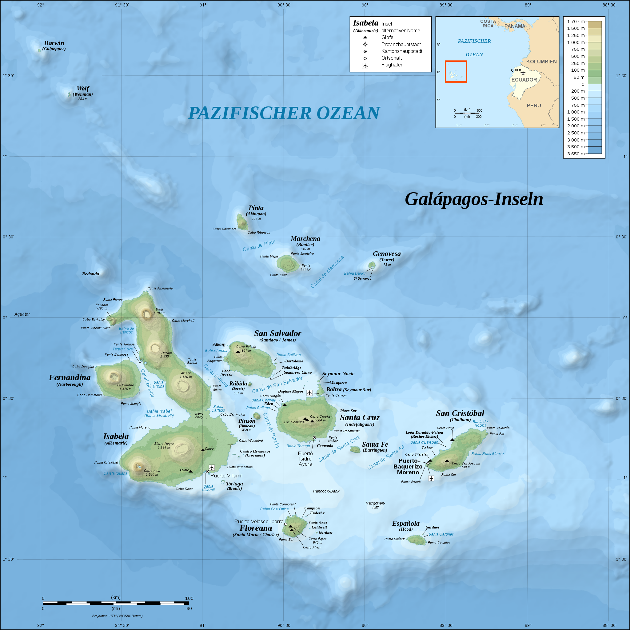
| 26. okt 2008 kl. 17:07 |  | 2.160 × 2.160 (2,62 MB) | NordNordWest | {{Location|00|30|00|S|90|30|00|W|scale:1000000}} <br/>{{Information |Description= {{de|Topografische and bathymetrische Karte der Galápagos-Inseln, Ecuador.}} {{en|Topographic and bathymetric map of the [[:en:Gal |
Myndarslóðir
Hesar síður slóða til hesa mynd:
Alheims fílunýtsla
Aðrar wkiir brúka hesa fílu:
- Nýtsla á af.wikipedia.org
- Nýtsla á cs.wikipedia.org
- Nýtsla á de.wikipedia.org
- Nýtsla á de.wikivoyage.org
- Nýtsla á en.wikisource.org
- Nýtsla á eo.wikipedia.org
- Nýtsla á frr.wikipedia.org
- Nýtsla á gl.wikipedia.org
- Nýtsla á hu.wikipedia.org
- Nýtsla á it.wikipedia.org
- Nýtsla á it.wikivoyage.org
- Nýtsla á ko.wikipedia.org
- Nýtsla á nn.wikipedia.org
- Nýtsla á ro.wikipedia.org
- Nýtsla á sl.wikipedia.org
- Nýtsla á stq.wikipedia.org
- Nýtsla á war.wikipedia.org