
Mynd:Thailand location map.svg

Size of this PNG preview of this SVG file: 341 × 600 pixels. Aðrar upploysnir: 136 × 240 pixels | 273 × 480 pixels | 436 × 768 pixels | 582 × 1.024 pixels | 1.164 × 2.048 pixels | 1.051 × 1.849 pixels.
Upprunafíla (SVG fíle, nominelt 1.051 × 1.849 pixel, fíle stødd: 662 KB)
Samandráttur
| Frágreiðing |
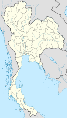
Deutsch: Positionskarte von Thailand
Quadratische Plattkarte, N-S-Streckung 103 %. Geographische Begrenzung der Karte:
English: Location map of Thailand
Equirectangular projection, N/S stretching 103 %. Geographic limits of the map:
|
| Dagur | |
| Kelda |
Egið verk, using
|
| Høvundur | NordNordWest |

|
This map has been made or improved in the German Kartenwerkstatt (Map Lab). You can propose maps to improve as well.
|
Lisensur
I, the copyright holder of this work, hereby publish it under the following licenses:

|
Loyvi verður givi at avrita, bera út og/ella broyta hetta skjal undir treytunum hjá GNU Free Documentation License, versión 1.2 ella einhvør seinni versjón ið er útgivin av Free Software Foundation; uttan nakað óbroytiligt brot, uttan forsíðutekst og uttan baksíðutekst. Eitt avrit av loyvinum er tikið við í brotinum ið nevnist GNU Free Documentation License. |
This file is licensed under the Creative Commons Attribution 3.0 Unported license.
- Tú ert vælkomin til:
- at deila – at avrita, breiða út og senda verkið
- at remiksa – at tillaga ella broyta verkið
- Undir hesum treytum:
- ognan – Tú mást ognarskrivað verkið á ein slíkan hátt sum er útgreinaður av høvundanum ella lisenseigaranum (men ikki á nakran hátt ið kundi bent á at hesin hevur góðkent teg ella tína nýtslu av verkinum).
Tú kanst velja tann lisens ið tú ynskir.
Søgan hjá fíluni
Trýst á dato/tíð fyri at síggja fíluna, sum hon sá út tá.
| Dagur/Tíð | Lítil mynd | Dimensjónir | Brúkari | Viðmerking | |
|---|---|---|---|---|---|
| streymur | 22. mar 2011 kl. 13:05 | | 1.051 × 1.849 (662 KB) | NordNordWest | update, new province |
| 14. apr 2009 kl. 18:00 |  | 1.052 × 1.849 (1,04 MB) | NordNordWest | corr | |
| 29. mar 2009 kl. 19:57 |  | 1.053 × 1.852 (924 KB) | NordNordWest | corr | |
| 29. mar 2009 kl. 18:03 |  | 1.053 × 1.852 (924 KB) | NordNordWest | corr | |
| 28. mar 2009 kl. 19:08 |  | 1.053 × 1.852 (925 KB) | NordNordWest | {{Information |Description= {{de|Positionskarte von Thailand}} Quadratische Plattkarte, N-S-Streckung 103 %. Geographische Begrenzung der Karte: * N: 20.6° N * S: 5.4° N * W: 97.1° O * O: 106.0° O {{en|Location map of [[:en:Thailand|T |
Myndarslóðir
Hesar síður slóða til hesa mynd:
Alheims fílunýtsla
Aðrar wkiir brúka hesa fílu:
- Nýtsla á af.wikipedia.org
- Nýtsla á als.wikipedia.org
- Nýtsla á an.wikipedia.org
- Nýtsla á ar.wikipedia.org
- Nýtsla á ast.wikipedia.org
- Nýtsla á az.wikipedia.org
- Nýtsla á ba.wikipedia.org
- Nýtsla á be-tarask.wikipedia.org
- Nýtsla á be.wikipedia.org
Vís meiri globala nýtslu av hesi fílu.