
Mynd:South Africa Provinces showing WC.png

Stødd av hesi forskoðan: 800 × 578 pixels. Aðrar upploysnir: 320 × 231 pixels | 640 × 462 pixels | 1.024 × 740 pixels | 1.146 × 828 pixels.
Upprunafíla (1.146 × 828 pixel, stødd fílu: 20 KB, MIME-slag: image/png)
Samandráttur
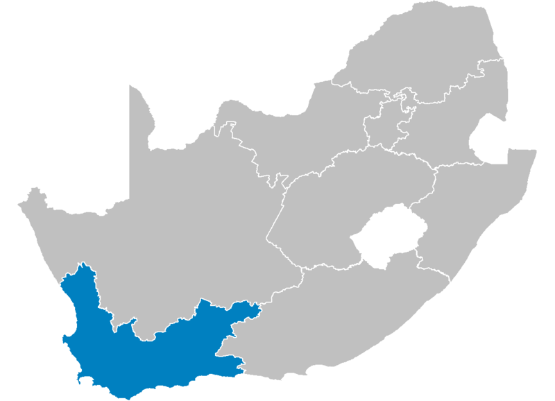
| Frágreiðing | Map of South Africa showing the Western Cape province after the 12th amendment of the constitution in December 2005. |
| Dagur | |
| Kelda | Created by me from Shapefile data from the Municipal Demarcation Board, South Africa. |
| Høvundur | Wayne Dam (User:Waynedam) |
| Loyvi (Endurnýtsla av hesi fílu) |
Dual-licensed under the GFDL and CC-By-SA-2.5, 2.0, and 1.0. |
Lisensur
I, the copyright holder of this work, hereby publish it under the following licenses:

|
Loyvi verður givi at avrita, bera út og/ella broyta hetta skjal undir treytunum hjá GNU Free Documentation License, versión 1.2 ella einhvør seinni versjón ið er útgivin av Free Software Foundation; uttan nakað óbroytiligt brot, uttan forsíðutekst og uttan baksíðutekst. Eitt avrit av loyvinum er tikið við í brotinum ið nevnist GNU Free Documentation License. |
| Henda fíla er gjørd atkomulig undir Creative Commons Navngev-Deil á sama hátt 3.0 Unported loyvinum. | ||
| ||
| This licensing tag was added to this file as part of the GFDL licensing update. |
This file is licensed under the Creative Commons Attribution-Share Alike 2.5 Generic, 2.0 Generic and 1.0 Generic license.
- Tú ert vælkomin til:
- at deila – at avrita, breiða út og senda verkið
- at remiksa – at tillaga ella broyta verkið
- Undir hesum treytum:
- ognan – Tú mást ognarskrivað verkið á ein slíkan hátt sum er útgreinaður av høvundanum ella lisenseigaranum (men ikki á nakran hátt ið kundi bent á at hesin hevur góðkent teg ella tína nýtslu av verkinum).
- deil undir somu treytum – Um tú broytir, evnar til ella byggir víðari á hetta verk, so kanst tú bert útgeva verkið undir somu ella líkandi lisensi sum hesin.
Tú kanst velja tann lisens ið tú ynskir.
Lisensur
I, the copyright holder of this work, hereby publish it under the following licenses:
|
|
Loyvi verður givi at avrita, bera út og/ella broyta hetta skjal undir treytunum hjá GNU Free Documentation License, versión 1.2 ella einhvør seinni versjón ið er útgivin av Free Software Foundation; uttan nakað óbroytiligt brot, uttan forsíðutekst og uttan baksíðutekst. Eitt avrit av loyvinum er tikið við í brotinum ið nevnist GNU Free Documentation License. |
| Henda fíla er gjørd atkomulig undir Creative Commons Navngev-Deil á sama hátt 3.0 Unported loyvinum. | ||
| ||
| This licensing tag was added to this file as part of the GFDL licensing update. |
This file is licensed under the Creative Commons Attribution 2.5 Generic license.
- Tú ert vælkomin til:
- at deila – at avrita, breiða út og senda verkið
- at remiksa – at tillaga ella broyta verkið
- Undir hesum treytum:
- ognan – Tú mást ognarskrivað verkið á ein slíkan hátt sum er útgreinaður av høvundanum ella lisenseigaranum (men ikki á nakran hátt ið kundi bent á at hesin hevur góðkent teg ella tína nýtslu av verkinum).
Tú kanst velja tann lisens ið tú ynskir.
Søgan hjá fíluni
Trýst á dato/tíð fyri at síggja fíluna, sum hon sá út tá.
| Dagur/Tíð | Lítil mynd | Dimensjónir | Brúkari | Viðmerking | |
|---|---|---|---|---|---|
| streymur | 29. apr 2006 kl. 14:21 | | 1.146 × 828 (20 KB) | Waynedam | == Summary == {{Information| |Description=Map of South Africa showing the Western Cape province after the 12th amendment of the constitution in December 2005. |Source=Created by me from Shapefile data from the [http://www.demarcation.org.za/ Municipal De |
Myndarslóðir
Hesar síður slóða til hesa mynd:
Alheims fílunýtsla
Aðrar wkiir brúka hesa fílu:
- Nýtsla á ar.wikipedia.org
- Nýtsla á bg.wikipedia.org
- Nýtsla á de.wikipedia.org
- Nýtsla á en.wikipedia.org
- Meadowridge
- Edgemead
- Onmeetbarediepgat
- Capri Village
- Parel Vallei
- Template:WesternCape-geo-stub
- Bishopscourt, Cape Town
- Langkloof Mountains
- Riviersonderend Mountains
- Olifants River (Southern Cape)
- Ashton, South Africa
- Norwood, Western Cape
- Heideveld
- Belhar
- Gondwana Game Reserve
- Franschhoek Pass
- Akkedisberg Pass
- Biedouw Valley
- Blinkberg Pass
- Bothmanskloof Pass
- Burgers Pass
- Dasklip Pass
- De Jagers Pass
- Du Plessis Pass
- Dwarskloof Pass
- Floorshoogte Pass
- Gydo Pass
- Gysmanshoek Pass
- Hex River Pass
- Hex River Poort Pass
- Houwhoek Pass
- Karatera Pass
- Orange Kloof
- Brandvlei Dam
- Duiwenhoks River
- Birkenhead, South Africa
- Dennehof, South Africa
- Van Dyks Bay
- Voëlklip
- Bonnievale, South Africa
- Romansrivier
- Languedoc, South Africa
- Chatsworth, Western Cape
- Ebenhaeser
- Eendekuil
- Grotto Bay
Vís meiri globala nýtslu av hesi fílu.