
Mynd:Russia edcp location map.svg

Size of this PNG preview of this SVG file: 800 × 431 pixels. Aðrar upploysnir: 320 × 173 pixels | 640 × 345 pixels | 1.024 × 552 pixels | 1.280 × 690 pixels | 2.560 × 1.381 pixels | 1.181 × 637 pixels.
Upprunafíla (SVG fíle, nominelt 1.181 × 637 pixel, fíle stødd: 2,59 MB)
Samandráttur
| Frágreiðing |
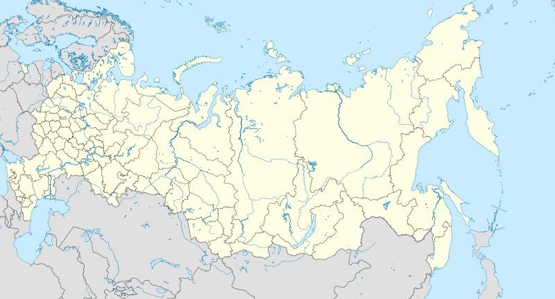
English: Location map of Russia.
EquiDistantConicProjection : Central parallel : * N: 54.0° N Central meridian : * E: 100.0° E Standard parallels: * 1: 49.0° N * 2: 59.0° N Made with Natural Earth. Free vector and raster map data @ naturalearthdata.com. Notice
Russia
other countries
disputed areas
international border
disputed border
Because the southern Kuril islands are claimed by Russia and Japan, they are shown as disputed. For more information about this see: en:Kuril Islands dispute. These islands are since 1945 under the jurisdiction of the Russian Federation. Русский: Схематическая карта России с границами субъектов федерации и водными ресурсами. Коническая равнопромежуточная проекция с центром по 54-й параллели северной широты и 100-му меридиану восточной долготы. На основе данных с сайта Natural Earth (www.naturalearthdata.com).
Особенности:
Условные обозначения:
Россия
другие страны
спорные территории
общепризнанные границы
спорные границы
|
| Dagur | |
| Kelda | Egið verk |
| Høvundur | Uwe Dedering |
| Other versions |
|

Lisensur
I, the copyright holder of this work, hereby publish it under the following license:
Henda fíla er gjørd atkomulig undir Creative Commons Navngev-Deil á sama hátt 3.0 Unported loyvinum.
- Tú ert vælkomin til:
- at deila – at avrita, breiða út og senda verkið
- at remiksa – at tillaga ella broyta verkið
- Undir hesum treytum:
- ognan – Tú mást ognarskrivað verkið á ein slíkan hátt sum er útgreinaður av høvundanum ella lisenseigaranum (men ikki á nakran hátt ið kundi bent á at hesin hevur góðkent teg ella tína nýtslu av verkinum).
- deil undir somu treytum – Um tú broytir, evnar til ella byggir víðari á hetta verk, so kanst tú bert útgeva verkið undir somu ella líkandi lisensi sum hesin.
Søgan hjá fíluni
Trýst á dato/tíð fyri at síggja fíluna, sum hon sá út tá.
| Dagur/Tíð | Lítil mynd | Dimensjónir | Brúkari | Viðmerking | |
|---|---|---|---|---|---|
| streymur | 27. jan 2016 kl. 10:33 | | 1.181 × 637 (2,59 MB) | Denniss | Reverted to version as of 11:36, 11 July 2015 (UTC) |
| 27. jan 2016 kl. 09:19 |  | 1.201 × 637 (3,5 MB) | BasilLeaf | Crimea part of the Russia Federation according to the Russian Government. Wikipedia shall remain neutral in all affairs and locator maps of each individual country shall comply with that country's internal rules | |
| 11. jul 2015 kl. 11:36 |  | 1.181 × 637 (2,59 MB) | Denniss | Reverted to version as of 14:44, 17 August 2014 | |
| 11. jul 2015 kl. 07:24 |  | 1.201 × 637 (3,5 MB) | Doni Vëntersenz | Crimea is now a part of Russian Federation. | |
| 17. aug 2014 kl. 14:44 |  | 1.181 × 637 (2,59 MB) | Denniss | Reverted to version as of 20:53, 25 April 2014 - stop revert warring, it's clearly states this map is showing Kuril islands as disputed | |
| 17. aug 2014 kl. 14:01 |  | 1.181 × 637 (2,86 MB) | Nicolay Sidorov | Reverted to version as of 23:14, 6 July 2012 - спорный статус Курильских островов | |
| 25. apr 2014 kl. 20:53 |  | 1.181 × 637 (2,59 MB) | Denniss | Reverted to version as of 16:09, 11 April 2014 | |
| 25. apr 2014 kl. 19:38 |  | 1.201 × 637 (3,5 MB) | Логаритам | Reverted to version as of 15:44, 11 April 2014 and what? | |
| 11. apr 2014 kl. 16:09 |  | 1.181 × 637 (2,59 MB) | NordNordWest | Reverted to version as of 15:33, 11 April 2014; please don't destroy all templates which are using this map | |
| 11. apr 2014 kl. 15:44 |  | 1.201 × 637 (3,5 MB) | NoviSadGrad |
Myndarslóðir
Hesar síður slóða til hesa mynd:
Alheims fílunýtsla
Aðrar wkiir brúka hesa fílu:
- Nýtsla á af.wikipedia.org
- Oimjakon
- Moskouse Kremlin
- Drie-eenheid-klooster van Sint Sergius
- Rooiplein
- Kolomenskoje
- Nowodewitsji-klooster
- Wit Monumente van Wladimir en Soezdal
- Ferapontof-klooster
- Vulkane van Kamtsjatka
- Kazanse Kremlin
- Goue Berge van Altai
- Solowjetski-klooster
- Sjabloon:Liggingkaart Rusland
- Tsjeko-meer
- Wladiwostok Internasionale Lughawe
- Bulgar
- Poetoranaplato
- Koerilemeer
- Nýtsla á als.wikipedia.org
- Nýtsla á ar.wikipedia.org
- Nýtsla á ast.wikipedia.org
Vís meiri globala nýtslu av hesi fílu.