
Mynd:Map of Virginia highlighting Richmond City.svg

Size of this PNG preview of this SVG file: 800 × 347 pixels. Aðrar upploysnir: 320 × 139 pixels | 640 × 278 pixels | 1.024 × 444 pixels | 1.280 × 555 pixels | 2.560 × 1.110 pixels | 7.486 × 3.247 pixels.
Upprunafíla (SVG fíle, nominelt 7.486 × 3.247 pixel, fíle stødd: 232 KB)
Samandráttur
| Frágreiðing |
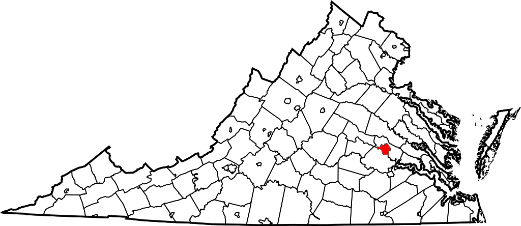
English: This is a locator map showing Richmond in Virginia. For more information, see Commons:United States county locator maps. |
| Dagur | |
| Kelda |
Egið verk: English: The maps use data from nationalatlas.gov, specifically countyp020.tar.gz on the Raw Data Download page. The maps also use state outline data from statesp020.tar.gz. The Florida maps use hydrogm020.tar.gz to display Lake Okeechobee. |
| Høvundur | David Benbennick |
Lisensur
| I, the copyright holder of this work, release this work into the public domain. This applies worldwide. In some countries this may not be legally possible; if so: I grant anyone the right to use this work for any purpose, without any conditions, unless such conditions are required by law. |
Søgan hjá fíluni
Trýst á dato/tíð fyri at síggja fíluna, sum hon sá út tá.
| Dagur/Tíð | Lítil mynd | Dimensjónir | Brúkari | Viðmerking | |
|---|---|---|---|---|---|
| streymur | 21. mar 2022 kl. 02:15 | | 7.486 × 3.247 (232 KB) | Enjoymoreradio | Corrected highlighted jurisdiction. Had been Richmond County, not the City of Richmond |
| 12. feb 2006 kl. 17:55 |  | 7.486 × 3.247 (223 KB) | David Benbennick | {{subst:User:Dbenbenn/clm|county=Richmond City|state=Virginia|type=city}} |
Myndarslóðir
Hesar síður slóða til hesa mynd:
Alheims fílunýtsla
Aðrar wkiir brúka hesa fílu:
- Nýtsla á af.wikipedia.org
- Nýtsla á br.wikipedia.org
- Nýtsla á en.wikipedia.org
- List of cities and counties in Virginia
- National Register of Historic Places listings in Richmond, Virginia
- Exchange Hotel (Richmond, Virginia)
- Template:RichmondCityVA-geo-stub
- User:LBourne/Scratch pad
- Brookbury, Virginia
- Huguenot Farms, Virginia
- South Garden, Richmond, Virginia
- South Richmond, Richmond, Virginia
- Southampton, Richmond, Virginia
- Westover Gardens, Virginia
- Powhite Park
- Upper Shockoe Valley
- Pine Camp, Richmond, Virginia
- Washington Park, Richmond
- Chamberlayne Industrial Center
- Carver, Richmond, Virginia
- Gilpin, Richmond, Virginia
- Green Park, Richmond, Virginia
- Jahnke, Richmond, Virginia
- Three Chopt
- Carillon, Richmond, Virginia
- Old Town Manchester
- Lockgreen
- Central Office District
- Randolph, Richmond, Virginia
- Texas Beach
- User:Nyttend/Virginia NRHP/City of Richmond
- Wikipedia:Village pump (technical)/Archive 154
- Wikipedia:Graphics Lab/Map workshop/Archive/Mar 2020
- Colonial Place, Richmond
- Nýtsla á et.wikipedia.org
- Nýtsla á fa.wikipedia.org
- Nýtsla á fi.wikipedia.org
- Nýtsla á fr.wikipedia.org
- Nýtsla á fy.wikipedia.org
- Nýtsla á gd.wikipedia.org
- Nýtsla á he.wikipedia.org
- Nýtsla á hr.wikipedia.org
- Nýtsla á id.wikipedia.org
- Nýtsla á io.wikipedia.org
- Nýtsla á ja.wikipedia.org
- Nýtsla á ko.wikipedia.org
- Nýtsla á mk.wikipedia.org
Vís meiri globala nýtslu av hesi fílu.