
Mynd:Map of Alaska highlighting North Slope Borough.svg

Size of this PNG preview of this SVG file: 800 × 423 pixels. Aðrar upploysnir: 320 × 169 pixels | 640 × 338 pixels | 1.024 × 541 pixels | 1.280 × 677 pixels | 2.560 × 1.353 pixels | 1.470 × 777 pixels.
Upprunafíla (SVG fíle, nominelt 1.470 × 777 pixel, fíle stødd: 338 KB)
Samandráttur
| Frágreiðing |
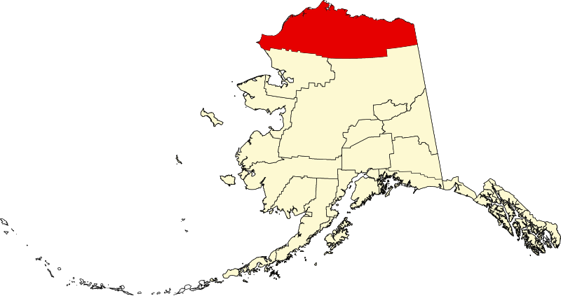
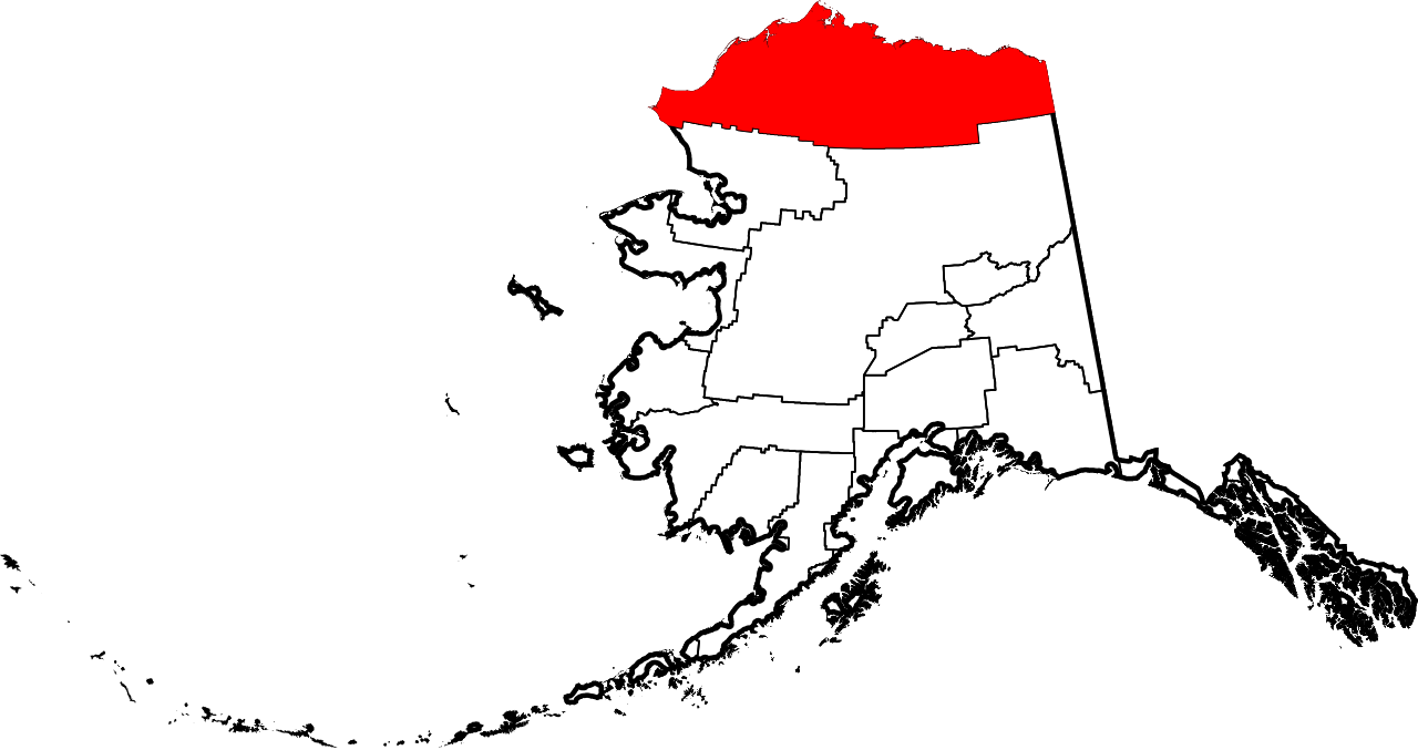
English: This is a locator map showing North Slope Borough in Alaska |
| Dagur | |
| Kelda |
Egið verk: English: The maps use data from nationalatlas.gov, specifically countyp020.tar.gz on the Raw Data Download page. The maps also use state outline data from statesp020.tar.gz. The Florida maps use hydrogm020.tar.gz to display Lake Okeechobee. |
| Høvundur | David Benbennick |
| SVG genesis |
Lisensur
| I, the copyright holder of this work, release this work into the public domain. This applies worldwide. In some countries this may not be legally possible; if so: I grant anyone the right to use this work for any purpose, without any conditions, unless such conditions are required by law. |
Søgan hjá fíluni
Trýst á dato/tíð fyri at síggja fíluna, sum hon sá út tá.
| Dagur/Tíð | Lítil mynd | Dimensjónir | Brúkari | Viðmerking | |
|---|---|---|---|---|---|
| streymur | 5. mar 2006 kl. 19:28 | | 1.470 × 777 (338 KB) | David Benbennick | {{subst:User:Dbenbenn/clm|county=North Slope Borough|state=Alaska|type=borough and census area}} |
Myndarslóðir
Hesar síður slóða til hesa mynd:
Alheims fílunýtsla
Aðrar wkiir brúka hesa fílu:
- Nýtsla á ar.wikipedia.org
- Nýtsla á azb.wikipedia.org
- Nýtsla á az.wikipedia.org
- Nýtsla á bpy.wikipedia.org
- Nýtsla á ca.wikipedia.org
- Nýtsla á ceb.wikipedia.org
- Nýtsla á ce.wikipedia.org
- Nýtsla á cy.wikipedia.org
- Nýtsla á de.wikipedia.org
- Nýtsla á en.wikipedia.org
- List of boroughs and census areas in Alaska
- North Slope Borough, Alaska
- Alpine, Alaska
- Anaktuvuk Pass, Alaska
- Atqasuk, Alaska
- Utqiagvik, Alaska
- Kaktovik, Alaska
- Nuiqsut, Alaska
- Point Hope, Alaska
- Point Lay, Alaska
- Prudhoe Bay, Alaska
- Wainwright, Alaska
- Iñupiat
- Kivalina River
- Ivishak River
- Wind River (Yukon–Koyukuk Census Area, Alaska)
Vís meiri globala nýtslu av hesi fílu.