
Mynd:Kodiak Island map in Alaska.png
Stødd av hesi forskoðan: 701 × 599 pixels. Aðrar upploysnir: 281 × 240 pixels | 561 × 480 pixels | 1.000 × 855 pixels.
Upprunafíla (1.000 × 855 pixel, stødd fílu: 629 KB, MIME-slag: image/png)
Samandráttur
| Frágreiðing |
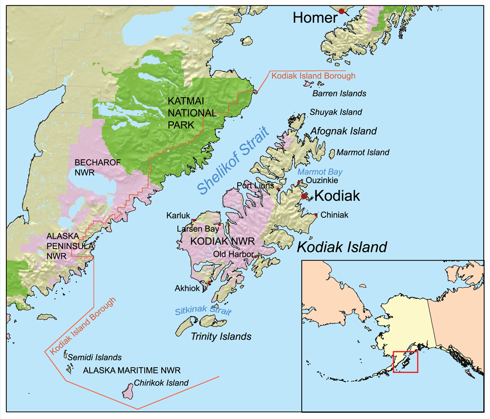
English: Map of the Kodiak Island. |
| Kelda | USGS |
| Høvundur | USGS |
This map of Kodiak Island and the surrounding area. I, Karl Musser, created it based on USGS data.
Lisensur
I, the copyright holder of this work, hereby publish it under the following license:
This file is licensed under the Creative Commons Attribution-Share Alike 2.5 Generic license.
- Tú ert vælkomin til:
- at deila – at avrita, breiða út og senda verkið
- at remiksa – at tillaga ella broyta verkið
- Undir hesum treytum:
- ognan – Tú mást ognarskrivað verkið á ein slíkan hátt sum er útgreinaður av høvundanum ella lisenseigaranum (men ikki á nakran hátt ið kundi bent á at hesin hevur góðkent teg ella tína nýtslu av verkinum).
- deil undir somu treytum – Um tú broytir, evnar til ella byggir víðari á hetta verk, so kanst tú bert útgeva verkið undir somu ella líkandi lisensi sum hesin.
Søgan hjá fíluni
Trýst á dato/tíð fyri at síggja fíluna, sum hon sá út tá.
| Dagur/Tíð | Lítil mynd | Dimensjónir | Brúkari | Viðmerking | |
|---|---|---|---|---|---|
| streymur | 22. mar 2007 kl. 19:32 | | 1.000 × 855 (629 KB) | Kmusser | This map of Kodiak Island and the surrounding area. I, Karl Musser, created it based on USGS data. {{self|cc-by-sa-2.5}} Category:Maps of Alaska |
Myndarslóðir
Hesar síður slóða til hesa mynd:
Alheims fílunýtsla
Aðrar wkiir brúka hesa fílu:
- Nýtsla á af.wikipedia.org
- Nýtsla á ar.wikipedia.org
- Nýtsla á arz.wikipedia.org
- Nýtsla á az.wikipedia.org
- Nýtsla á bg.wikipedia.org
- Nýtsla á bn.wikipedia.org
- Nýtsla á ca.wikipedia.org
- Nýtsla á ce.wikipedia.org
- Nýtsla á de.wikipedia.org
- Nýtsla á el.wikipedia.org
- Nýtsla á en.wikipedia.org
- Nýtsla á es.wikipedia.org
- Nýtsla á et.wikipedia.org
- Nýtsla á eu.wikipedia.org
- Nýtsla á fa.wikipedia.org
- Nýtsla á fi.wikipedia.org
- Nýtsla á frr.wikipedia.org
- Nýtsla á fr.wikipedia.org
- Nýtsla á fy.wikipedia.org
- Nýtsla á gl.wikipedia.org
- Nýtsla á he.wikipedia.org
- Nýtsla á hr.wikipedia.org
- Nýtsla á ht.wikipedia.org
- Nýtsla á hu.wikipedia.org
- Nýtsla á id.wikipedia.org
- Nýtsla á is.wikipedia.org
- Nýtsla á it.wikipedia.org
Vís meiri globala nýtslu av hesi fílu.