
Mynd:England locator map with North East England highlighted.svg

Size of this PNG preview of this SVG file: 494 × 600 pixels. Aðrar upploysnir: 198 × 240 pixels | 395 × 480 pixels | 632 × 768 pixels | 843 × 1.024 pixels | 1.686 × 2.048 pixels | 816 × 991 pixels.
Upprunafíla (SVG fíle, nominelt 816 × 991 pixel, fíle stødd: 469 KB)
| Frágreiðing |
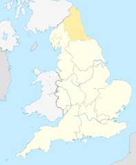
English: Equirectangular projection of England; North East England is highlighted. |
| Dagur | |
| Kelda | File:England location map.svg |
| Høvundur | |
| Loyvi (Endurnýtsla av hesi fílu) |
Henda fíla er gjørd atkomulig undir Creative Commons Navngev-Deil á sama hátt 3.0 Unported loyvinum.
|
Søgan hjá fíluni
Trýst á dato/tíð fyri at síggja fíluna, sum hon sá út tá.
| Dagur/Tíð | Lítil mynd | Dimensjónir | Brúkari | Viðmerking | |
|---|---|---|---|---|---|
| streymur | 8. apr 2010 kl. 09:34 | | 816 × 991 (469 KB) | Jappalang | {{Information |Description=Equirectangular projection of England; Northumberland is highlighted |Source=File:England location map.svg |Date=2010-04-08 |Author=* File:England location map.svg: Spischot * author: [[User:Jappalang |
Myndarslóðir
Hesar síður slóða til hesa mynd:
Alheims fílunýtsla
Aðrar wkiir brúka hesa fílu:
- Nýtsla á am.wikipedia.org
- Nýtsla á ar.wikipedia.org
- Nýtsla á as.wikipedia.org
- Nýtsla á bh.wikipedia.org
- Nýtsla á blk.wikipedia.org
- Nýtsla á bn.wikipedia.org
- Nýtsla á bs.wikipedia.org
- Nýtsla á ca.wikipedia.org
- Nýtsla á cy.wikipedia.org
- Nýtsla á da.wikipedia.org
- Nýtsla á diq.wikipedia.org
- Nýtsla á dty.wikipedia.org
- Nýtsla á dv.wikipedia.org
- Nýtsla á en.wikipedia.org
- Template:Location map+
- Template:Location map~
- Template:Location map+/doc
- Template:Location map+/sandbox
- Template:Location map+/testcases
- Template:Location map~/sandbox
- Template:Location map+/AlternativeMap
- User:Arjunaraoc/sandbox/SampleMap1
- User:Arjunaraoc/sandbox/SampleMap2
- User:Arjunaraoc/sandbox/SampleMap3
- Nýtsla á en.wikibooks.org
- Nýtsla á en.wikiversity.org
- Nýtsla á fa.wikipedia.org
Vís meiri globala nýtslu av hesi fílu.