
Mynd:Donegal Carrickfin Airport - View to the east - geograph.org.uk - 1174831.jpg
Ongin hægri upploysn varð funnin.
Donegal_Carrickfin_Airport_-_View_to_the_east_-_geograph.org.uk_-_1174831.jpg (640 × 426 pixel, stødd fílu: 193 KB, MIME-slag: image/jpeg)
Samandráttur
| Frágreiðing |
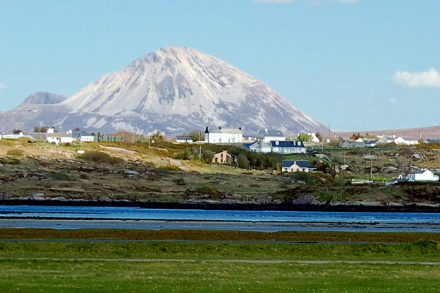
English: Donegal Carrickfin Airport - View to the east Shown in the foreground is the peninsula that the airport is located on and a small bay east of that peninsula. Shown in the near background is part of a residential area near Rinnafarset. Beyond that is the awesome sight of Mount Errigal. |
||
| Dagur | |||
| Kelda | From geograph.org.uk | ||
| Høvundur | Joseph Mischyshyn | ||
| Loyvi (Endurnýtsla av hesi fílu) |
This file is licensed under the Creative Commons Attribution-Share Alike 2.0 Generic license. Ognan: Joseph Mischyshyn
|
||
| Ognan (required by the license) | Joseph Mischyshyn / Donegal Carrickfin Airport - View to the east / | ||

| Camera location | | View this and other nearby images on: OpenStreetMap |
|---|
_heading:90.00&language=fo)
| Object location | | View this and other nearby images on: OpenStreetMap |
|---|
_heading:90.00&language=fo)
Søgan hjá fíluni
Trýst á dato/tíð fyri at síggja fíluna, sum hon sá út tá.
| Dagur/Tíð | Lítil mynd | Dimensjónir | Brúkari | Viðmerking | |
|---|---|---|---|---|---|
| streymur | 25. feb 2011 kl. 17:04 | | 640 × 426 (193 KB) | GeographBot | == {{int:filedesc}} == {{Information |description={{en|1=Donegal Carrickfin Airport - View to the east Shown in the foreground is the peninsula that the airport is located on and a small bay east of that peninsula. Shown in the near background is part of |
Myndarslóðir
Hesar síður slóða til hesa mynd:
Alheims fílunýtsla
Aðrar wkiir brúka hesa fílu:
- Nýtsla á en.wikipedia.org
- Nýtsla á gl.wikipedia.org
- Nýtsla á gv.wikipedia.org
- Nýtsla á hr.wikipedia.org
- Nýtsla á it.wikipedia.org
- Nýtsla á no.wikipedia.org
- Nýtsla á pl.wikipedia.org