
Mynd:Boundary map of Venice neighborhood in Los Angeles, California.png
Boundary_map_of_Venice_neighborhood_in_Los_Angeles,_California.png (443 × 398 pixel, stødd fílu: 235 KB, MIME-slag: image/png)
Samandráttur
| Description |
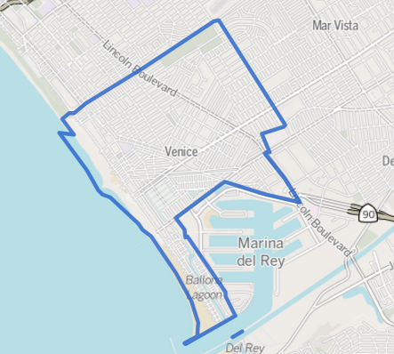
This map was created from OpenStreetMap project data, collected by the community. This map may be incomplete, and may contain errors. Don't rely solely on it for navigation. |
|||
| Dagur | 12 juni 2013 (upload date) | |||
| Kelda | openstreetmap.org | |||
| Skapari |
OpenStreetMap contributers; boundary lines added here by the Los Angeles Times OpenStreetMap contributors |
|||
| Loyvi (Endurnýtsla av hesi fílu) |
OpenStreetMap data is available under the Open Database License (details). Map tiles are licensed under the Creative Commons Attribution-ShareAlike 2.0 license (CC-BY-SA 2.0).
This file is licensed under the Creative Commons Attribution-Share Alike 2.0 Generic license.
|
|||
| Georeferencing | If inappropriate please set warp_status = skip to hide. |
Original upload log
Transferred from en.wikipedia to Commons using For the Common Good.
| Dagur/Tíð | Dimensjónir | Brúkari | Viðmerking |
|---|---|---|---|
| 23:54, 12 June 2013 | 443 × 398 (240,854 bytes) | w:en:GeorgeLouis (kjak | íkøst) | (Uploading a file from a free published source using [[Wikipedia:File_Upload_Wizard|File Upload Wizard]]) |
Søgan hjá fíluni
Trýst á dato/tíð fyri at síggja fíluna, sum hon sá út tá.
| Dagur/Tíð | Lítil mynd | Dimensjónir | Brúkari | Viðmerking | |
|---|---|---|---|---|---|
| streymur | 18. jun 2013 kl. 05:10 | | 443 × 398 (235 KB) | ALH | Transferred from en.wikipedia: see original upload log above |
Myndarslóðir
Hesar síður slóða til hesa mynd:
Alheims fílunýtsla
Aðrar wkiir brúka hesa fílu:
- Nýtsla á af.wikipedia.org
- Nýtsla á ar.wikipedia.org
- Nýtsla á azb.wikipedia.org
- Nýtsla á ca.wikipedia.org
- Nýtsla á ceb.wikipedia.org
- Nýtsla á cs.wikipedia.org
- Nýtsla á en.wikipedia.org
- Nýtsla á eo.wikipedia.org
- Nýtsla á es.wikipedia.org
- Nýtsla á eu.wikipedia.org
- Nýtsla á fa.wikipedia.org
- Nýtsla á fi.wikipedia.org
- Nýtsla á fr.wikipedia.org
- Nýtsla á it.wikipedia.org
- Nýtsla á it.wikivoyage.org
- Nýtsla á la.wikipedia.org
- Nýtsla á uk.wikipedia.org
- Nýtsla á ur.wikipedia.org
- Nýtsla á www.wikidata.org