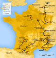
Mynd:2017 Tour de France map.png

Stødd av hesi forskoðan: 576 × 600 pixels. Aðrar upploysnir: 230 × 240 pixels | 461 × 480 pixels | 737 × 768 pixels | 983 × 1.024 pixels | 2.120 × 2.208 pixels.
Upprunafíla (2.120 × 2.208 pixel, stødd fílu: 2,73 MB, MIME-slag: image/png)
Søgan hjá fíluni
Trýst á dato/tíð fyri at síggja fíluna, sum hon sá út tá.
| Dagur/Tíð | Lítil mynd | Dimensjónir | Brúkari | Viðmerking | |
|---|---|---|---|---|---|
| streymur | 17. jan 2017 kl. 21:42 |  | 2.120 × 2.208 (2,73 MB) | BaldBoris | correct stage numbers |
| 18. des 2016 kl. 09:15 |  | 2.120 × 2.208 (2,73 MB) | BaldBoris | == {{int:filedesc}} == {{Information |Description=Route map of the 2017 Tour de France. |Source= * File:Tour de France 2015 map-fr.svg by {{u|Sémhur}} under licence FreeArt or CC-BY-SA 4.0 |Date=2016-12-18 |Author=[[Us... |
Myndarslóðir
Hesar síður slóða til hesa mynd:
Alheims fílunýtsla
Aðrar wkiir brúka hesa fílu:
- Nýtsla á ar.wikipedia.org
- Nýtsla á ast.wikipedia.org
- Nýtsla á br.wikipedia.org
- Nýtsla á ca.wikipedia.org
- Nýtsla á cs.wikipedia.org
- Nýtsla á da.wikipedia.org
- Nýtsla á de.wikipedia.org
- Nýtsla á en.wikipedia.org
- Nýtsla á eo.wikipedia.org
- Nýtsla á es.wikipedia.org
- Nýtsla á eu.wikipedia.org
- Nýtsla á fa.wikipedia.org
- Nýtsla á fi.wikipedia.org
- Nýtsla á fr.wikipedia.org
- Nýtsla á fr.wikinews.org
- Nýtsla á hr.wikipedia.org
- Nýtsla á hu.wikipedia.org
- Nýtsla á it.wikipedia.org
- Nýtsla á ja.wikipedia.org
- Nýtsla á la.wikipedia.org
- Nýtsla á lb.wikipedia.org
- Nýtsla á lv.wikipedia.org
- Nýtsla á mk.wikipedia.org
- Nýtsla á nl.wikipedia.org
- Nýtsla á nl.wikinews.org
- Nýtsla á no.wikipedia.org
- Nýtsla á pl.wikipedia.org
- Nýtsla á pt.wikipedia.org
- Nýtsla á ru.wikipedia.org
- Nýtsla á sk.wikipedia.org
- Nýtsla á sv.wikipedia.org
- Nýtsla á vi.wikipedia.org
- Nýtsla á www.wikidata.org
- Nýtsla á zh.wikipedia.org
