
Mynd:Sumba and Beinisvord in Suduroy, Faroe Islands.JPG

Stødd av hesi forskoðan: 800 × 600 pixels. Aðrar upploysnir: 320 × 240 pixels | 640 × 480 pixels | 1.024 × 768 pixels | 1.280 × 960 pixels | 2.560 × 1.920 pixels | 3.648 × 2.736 pixels.
Upprunafíla (3.648 × 2.736 pixel, stødd fílu: 2,06 MB, MIME-slag: image/jpeg)
Samandráttur
| Frágreiðing |
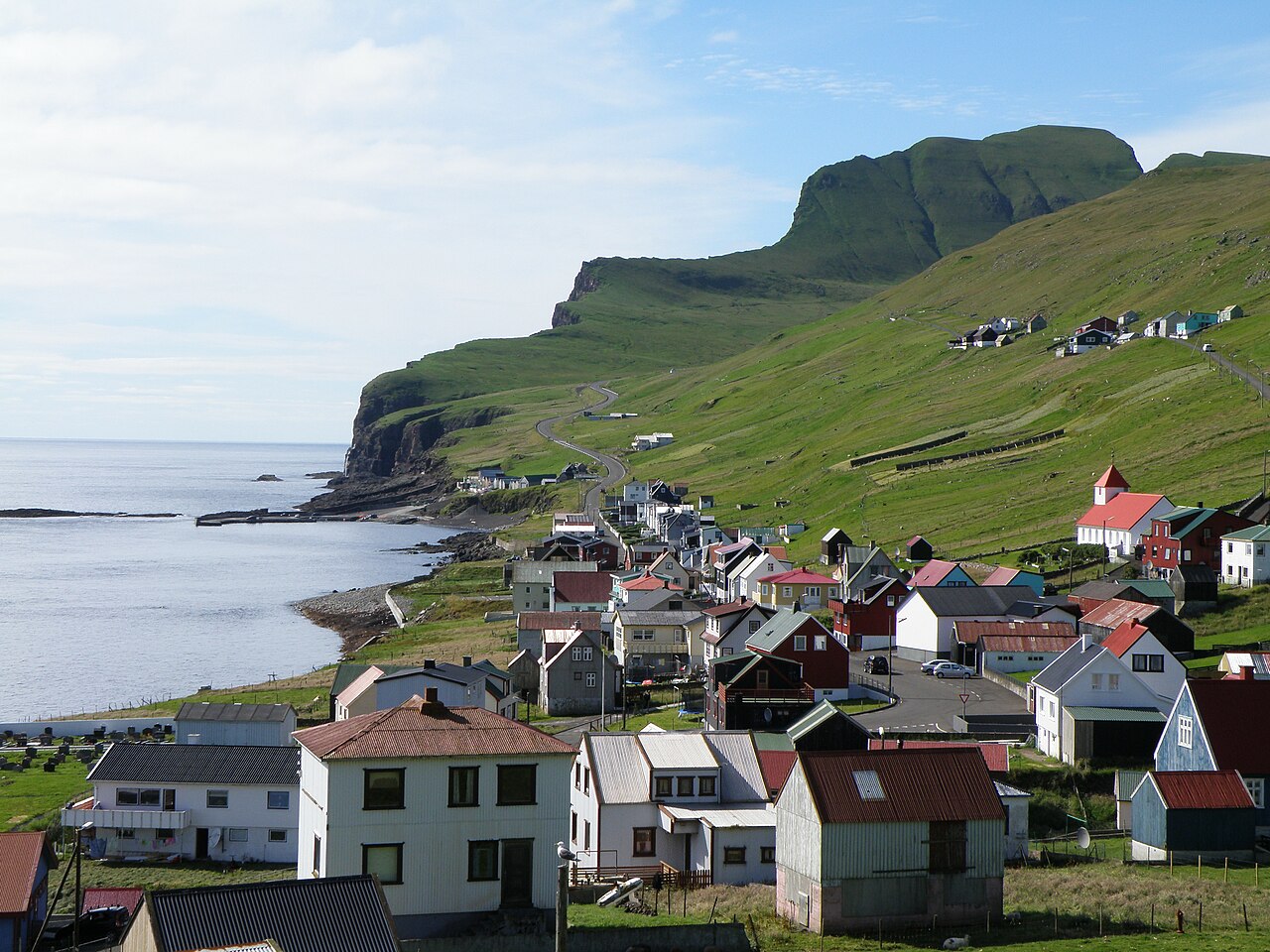
English: Sumba is the southernmost village in the Faroe Islands, located on the south-western coast of the island Suðuroy. Beinisvørð is a 470 meter high sea cliff. It goes vertically down to the North Atlantic Ocean on the western side and on its eastern side it has a green slope, as one can see on this photo. The population of Sumba is around 250. The population of the island Suðuroy is ca. 4900.
Dansk: Sumba er den sydligste bygd på Færøerne. Sumba vender mod sydvest og er karakteriseret af den 470 meter høje klint Beinisvørð, som beskytter bygden mod nordvest. Sumba ligger dog mod åbent hav mod sydvest, kun delvis beskyttet af Sumbiarhólmur. Der bor ca. 250 mennesker i Sumba. Bygden er forbundet med Lopra via en tunnel og med en vej som går over bjergene, forbi Beinisvørð.
Føroyskt: Sumba er bygd í Føroyum. Sumba er syðsta bygd í Suðuroynni. |
| Dagur | |
| Kelda | Egið verk |
| Høvundur | Eileen Sandá |
Lisensur
I, the copyright holder of this work, hereby publish it under the following licenses:
Henda fíla er gjørd atkomulig undir Creative Commons Navngev-Deil á sama hátt 3.0 Unported loyvinum.
- Tú ert vælkomin til:
- at deila – at avrita, breiða út og senda verkið
- at remiksa – at tillaga ella broyta verkið
- Undir hesum treytum:
- ognan – Tú mást ognarskrivað verkið á ein slíkan hátt sum er útgreinaður av høvundanum ella lisenseigaranum (men ikki á nakran hátt ið kundi bent á at hesin hevur góðkent teg ella tína nýtslu av verkinum).
- deil undir somu treytum – Um tú broytir, evnar til ella byggir víðari á hetta verk, so kanst tú bert útgeva verkið undir somu ella líkandi lisensi sum hesin.

|
Loyvi verður givi at avrita, bera út og/ella broyta hetta skjal undir treytunum hjá GNU Free Documentation License, versión 1.2 ella einhvør seinni versjón ið er útgivin av Free Software Foundation; uttan nakað óbroytiligt brot, uttan forsíðutekst og uttan baksíðutekst. Eitt avrit av loyvinum er tikið við í brotinum ið nevnist GNU Free Documentation License. |
Tú kanst velja tann lisens ið tú ynskir.
Søgan hjá fíluni
Trýst á dato/tíð fyri at síggja fíluna, sum hon sá út tá.
| Dagur/Tíð | Lítil mynd | Dimensjónir | Brúkari | Viðmerking | |
|---|---|---|---|---|---|
| streymur | 18. apr 2011 kl. 17:23 | | 3.648 × 2.736 (2,06 MB) | EileenSanda | {{Information |Description ={{en|1=Sumba is the southernmost village in the Faroe Islands, located on the south-western coast of the island Suðuroy. Beinisvørð is a 470 meter high sea cliff. It goes vertically down to the North Atlantic Ocean on the |
Myndarslóðir
Hesar síður slóða til hesa mynd:
Alheims fílunýtsla
Aðrar wkiir brúka hesa fílu:
- Nýtsla á ca.wikipedia.org
- Nýtsla á da.wikipedia.org
- Nýtsla á el.wikipedia.org
- Nýtsla á en.wikipedia.org
- Nýtsla á es.wikipedia.org
- Nýtsla á eu.wikipedia.org
- Nýtsla á is.wikipedia.org
- Nýtsla á it.wikipedia.org
- Nýtsla á lt.wikipedia.org
- Nýtsla á nl.wikipedia.org
- Nýtsla á no.wikipedia.org
- Nýtsla á pl.wikipedia.org
- Nýtsla á zh.wikipedia.org