
Mynd:SFRYmap.PNG

Stødd av hesi forskoðan: 800 × 600 pixels. Aðrar upploysnir: 320 × 240 pixels | 640 × 480 pixels | 1.024 × 768 pixels | 1.280 × 960 pixels | 1.600 × 1.200 pixels.
Upprunafíla (1.600 × 1.200 pixel, stødd fílu: 836 KB, MIME-slag: image/png)
Samandráttur

|
This locator map image could be re-created using vector graphics as an SVG file. This has several advantages; see Commons:Media for cleanup for more information. If an SVG form of this image is available, please upload it and afterwards replace this template with
{{vector version available|new image name}}.
It is recommended to name the SVG file “SFRYmap.svg”—then the template Vector version available (or Vva) does not need the new image name parameter. |
Samandráttur
| Frágreiðing |
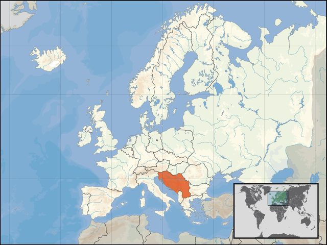
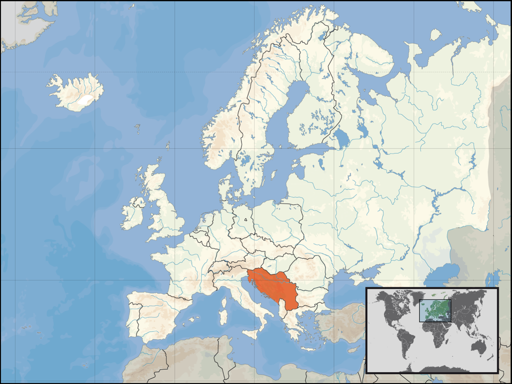
English: locator map for SFRY.
Deutsch: Lage des früheren Jugoslawiens. |
| Dagur | |
| Kelda | derived by the "Europe location" map series created by David Liuzzo |
| Høvundur | Bože pravde |
| Other versions | Derivative works of this file: Italy Yugoslavia Locator.png |
This map is based on David Liuzzo's locator maps. As that maps are under the GFDL, this map is too.
Lisensur

|
Loyvi verður givi at avrita, bera út og/ella broyta hetta skjal undir treytunum hjá GNU Free Documentation License, versión 1.2 ella einhvør seinni versjón ið er útgivin av Free Software Foundation; uttan nakað óbroytiligt brot, uttan forsíðutekst og uttan baksíðutekst. Eitt avrit av loyvinum er tikið við í brotinum ið nevnist GNU Free Documentation License. |
| Henda fíla er gjørd atkomulig undir Creative Commons Navngev-Deil á sama hátt 3.0 Unported loyvinum. | ||
| ||
| This licensing tag was added to this file as part of the GFDL licensing update. |
Søgan hjá fíluni
Trýst á dato/tíð fyri at síggja fíluna, sum hon sá út tá.
| Dagur/Tíð | Lítil mynd | Dimensjónir | Brúkari | Viðmerking | |
|---|---|---|---|---|---|
| streymur | 14. mar 2008 kl. 19:40 | | 1.600 × 1.200 (836 KB) | Lencer | Add West-Berlin, delete false river Havel/Spree |
| 14. mar 2008 kl. 12:48 |  | 1.600 × 1.200 (571 KB) | Kmusser | corrected internal German boundary | |
| 18. aug 2007 kl. 20:24 |  | 1.600 × 1.200 (531 KB) | B1mbo | Removed Soviet borders | |
| 16. jan 2007 kl. 22:19 |  | 1.600 × 1.200 (576 KB) | Bože pravde~commonswiki | newer version | |
| 12. des 2006 kl. 04:04 |  | 800 × 600 (212 KB) | Bože pravde~commonswiki | This is a locator map for en:SFRY. This map is based off of David Liuzzo's locator map. As that map is under the GFDL, this map is too. ==Licensing== {{GFDL}} Category:Locator maps for countries [[Category:Maps of Yugosla |
Myndarslóðir
Hesar síður slóða til hesa mynd:
Alheims fílunýtsla
Aðrar wkiir brúka hesa fílu:
- Nýtsla á an.wikipedia.org
- Nýtsla á ar.wikipedia.org
- Nýtsla á cs.wikipedia.org
- Nýtsla á de.wikipedia.org
- Nýtsla á de.wikibooks.org
- Nýtsla á de.wiktionary.org
- Nýtsla á en.wikipedia.org
- Nýtsla á eo.wikipedia.org
- Nýtsla á fa.wikipedia.org
- Nýtsla á gl.wikipedia.org
- Nýtsla á is.wikipedia.org
- Nýtsla á it.wikipedia.org
- Nýtsla á ka.wikipedia.org
- Nýtsla á lb.wikipedia.org
- Nýtsla á li.wiktionary.org
- Nýtsla á mk.wikipedia.org
- Nýtsla á pl.wiktionary.org
- Nýtsla á roa-rup.wikipedia.org
- Nýtsla á ru.wikipedia.org
- Nýtsla á sh.wikipedia.org
- Nýtsla á simple.wikipedia.org
- Nýtsla á sl.wikipedia.org
- Nýtsla á sr.wikipedia.org
- Nýtsla á sw.wikipedia.org
- Nýtsla á tg.wikipedia.org
- Nýtsla á uk.wikipedia.org
- Nýtsla á www.wikidata.org
- Nýtsla á yo.wikipedia.org