
Mynd:NO 1103 Stavanger.svg

Size of this PNG preview of this SVG file: 465 × 600 pixels. Aðrar upploysnir: 186 × 240 pixels | 372 × 480 pixels | 595 × 768 pixels | 794 × 1.024 pixels | 1.588 × 2.048 pixels | 635 × 819 pixels.
Upprunafíla (SVG fíle, nominelt 635 × 819 pixel, fíle stødd: 178 KB)
| Frágreiðing |
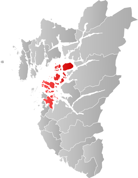
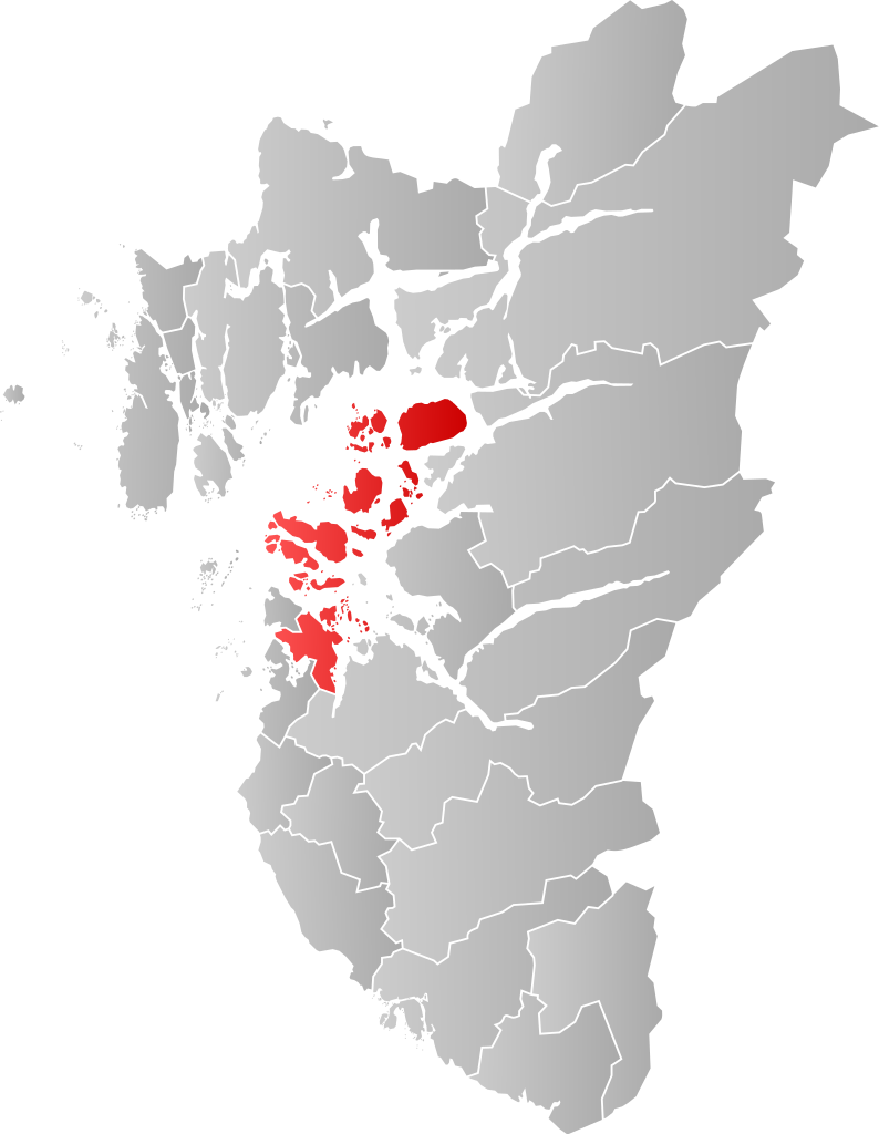
Norsk bokmål: Kart som viser [[:no: {{{1}}}| {{{1}}}]]s plassering innen [[:no: {{{2}}}| {{{2}}}]], laga av Jon Harald Søby.
English: Map showing the position of [[:w: {{{1}}}| {{{1}}}]] within [[:w: {{{2}}}| {{{2}}}]], made by Jon Harald Søby.
Svenska: Karta som visar [[:sv: {{{1}}}| {{{1}}}]] kommuns läge i [[:Category:{{{2}}}|{{{2}}}]] fylke, skapad av Jon Harald Søby. |
||
| Dagur | |||
| Kelda | Egið verk | ||
| Høvundur | Jon Harald Søby | ||
| Loyvi (Endurnýtsla av hesi fílu) |
|
||
| SVG genesis |
[[Category:Locator maps of {{{2}}}]] [[Category:{{{1}}}]]
Søgan hjá fíluni
Trýst á dato/tíð fyri at síggja fíluna, sum hon sá út tá.
| Dagur/Tíð | Lítil mynd | Dimensjónir | Brúkari | Viðmerking | |
|---|---|---|---|---|---|
| streymur | 23. des 2019 kl. 02:42 | | 635 × 819 (178 KB) | Jay1279 | update with 2020 municipal border changes |
| 22. jan 2007 kl. 18:07 |  | 544 × 712 (105 KB) | Jon Harald Søby | {{User:Jon Harald Søby/Kartlisens|Stavanger|Rogaland}} |
Myndarslóðir
Hesar síður slóða til hesa mynd:
Alheims fílunýtsla
Aðrar wkiir brúka hesa fílu:
- Nýtsla á af.wikipedia.org
- Nýtsla á ar.wikipedia.org
- Nýtsla á arz.wikipedia.org
- Nýtsla á bpy.wikipedia.org
- Nýtsla á bs.wikipedia.org
- Nýtsla á ca.wikipedia.org
- Nýtsla á ce.wikipedia.org
- Nýtsla á da.wikipedia.org
- Nýtsla á de.wikipedia.org
- Nýtsla á el.wikipedia.org
- Nýtsla á en.wikipedia.org
- Nýtsla á eo.wikipedia.org
- Nýtsla á es.wikipedia.org
- Nýtsla á eu.wikipedia.org
- Nýtsla á fa.wikipedia.org
- Nýtsla á fr.wikipedia.org
- Nýtsla á gl.wikipedia.org
- Nýtsla á ha.wikipedia.org
- Nýtsla á hu.wikipedia.org
- Nýtsla á hy.wikipedia.org
- Nýtsla á ia.wikipedia.org
- Nýtsla á ie.wikipedia.org
- Nýtsla á it.wikipedia.org
- Nýtsla á ja.wikipedia.org
- Nýtsla á ka.wikipedia.org
- Nýtsla á ko.wikipedia.org
- Nýtsla á la.wikipedia.org
- Nýtsla á li.wikipedia.org
- Nýtsla á nds.wikipedia.org
- Nýtsla á nl.wikipedia.org
- Nýtsla á nn.wikipedia.org
- Nýtsla á no.wikipedia.org
Vís meiri globala nýtslu av hesi fílu.