
Mynd:Location of Huancavelica Region.png
Ongin hægri upploysn varð funnin.
Location_of_Huancavelica_Region.png (238 × 347 pixel, stødd fílu: 25 KB, MIME-slag: image/png)

|
File:Peru - Huancavelica Department (locator map).svg is a vector version of this file. It should be used in place of this PNG file when not inferior.
File:Location of Huancavelica Region.png → File:Peru - Huancavelica Department (locator map).svg
For more information, see Help:SVG. |
.svg) |
Samandráttur
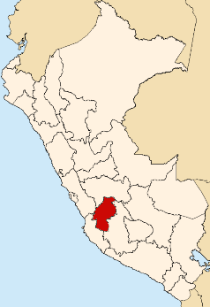
| Frágreiðing | Map showing the location of the Huancavelica region in Peru |
| Dagur | |
| Kelda | Egið verk |
| Høvundur | AgainErick |
Lisensur
| I, the copyright holder of this work, release this work into the public domain. This applies worldwide. In some countries this may not be legally possible; if so: I grant anyone the right to use this work for any purpose, without any conditions, unless such conditions are required by law. |
Søgan hjá fíluni
Trýst á dato/tíð fyri at síggja fíluna, sum hon sá út tá.
| Dagur/Tíð | Lítil mynd | Dimensjónir | Brúkari | Viðmerking | |
|---|---|---|---|---|---|
| streymur | 11. aug 2007 kl. 21:50 | | 238 × 347 (25 KB) | AgainErick | {{Information |Description=Map showing the location of the Huancavelica region in Peru |Source=self-made |Date=August 11, 2007 |Author= Eric Bronder }} Huancavelica |
Myndarslóðir
Hesar síður slóða til hesa mynd:
Alheims fílunýtsla
Aðrar wkiir brúka hesa fílu:
- Nýtsla á ba.wikipedia.org
- Nýtsla á en.wikipedia.org
- Department of Huancavelica
- Churcampa Province
- Huaytará Province
- Tayacaja Province
- Acobamba Province
- Angaraes Province
- Huancavelica Province
- Castrovirreyna Province
- Huayacundo Arma District
- Quito-Arma District
- Acobamba District, Acobamba
- Chinchihuasi District
- Anco District, Churcampa
- Churcampa District
- El Carmen District, Churcampa
- La Merced District, Churcampa
- Locroja District
- Pachamarca District
- Paucarbamba District
- San Miguel de Mayocc District
- San Pedro de Coris District
- Acobambilla District
- Acoria District
- Ascensión District
- Conayca District
- Cuenca District, Huancavelica
- Huachocolpa District, Huancavelica
- Huancavelica District
- Huando District
- Huayllahuara District
- Izcuchaca District
- Laria District
- Manta District
- Mariscal Cáceres District, Huancavelica
- Moya District
- Nuevo Occoro District
- Palca District, Huancavelica
- Pilchaca District
- Vilca District
- Yauli District, Huancavelica
- Arma District
- Aurahua District
- Capillas District
- Castrovirreyna District
- Cocas District
- Huachos District
- Huamatambo District
- Mollepampa District
- San Juan District, Castrovirreyna
Vís meiri globala nýtslu av hesi fílu.