
Mynd:Fixed gulf map.png
Ongin hægri upploysn varð funnin.
Fixed_gulf_map.png (734 × 600 pixel, stødd fílu: 1.001 KB, MIME-slag: image/png)
Samandráttur
| Frágreiðing |
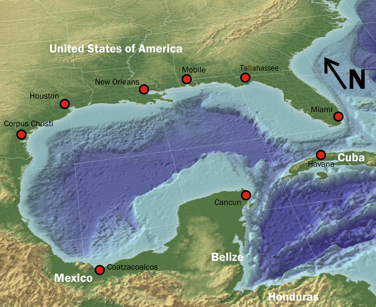
English: "The Gulf of Mexico in 3D perspective. A GIS can create very accurate and realistic-looking environments." |
| Kelda | Source (High-Res: 3000x2451) |
| Høvundur | NOAA |
| Loyvi (Endurnýtsla av hesi fílu) |
Public domain |
| Other versions |
 |
Lisensur
This image is in the public domain because it contains materials that originally came from the U.S. National Oceanic and Atmospheric Administration, taken or made as part of an employee's official duties.
|
Søgan hjá fíluni
Trýst á dato/tíð fyri at síggja fíluna, sum hon sá út tá.
| Dagur/Tíð | Lítil mynd | Dimensjónir | Brúkari | Viðmerking | |
|---|---|---|---|---|---|
| streymur | 4. mai 2010 kl. 04:07 | | 734 × 600 (1.001 KB) | GatorSlayerFSU | {{Information |Description={{en|1=Fixed the gap in pic}} |Source=Public Domain |Author=GatorSlayerFSU |Date=5/4/10 |Permission= |other_versions= }} |
Myndarslóðir
Hesar síður slóða til hesa mynd:
Alheims fílunýtsla
Aðrar wkiir brúka hesa fílu:
- Nýtsla á arc.wikipedia.org
- Nýtsla á azb.wikipedia.org
- Nýtsla á az.wikipedia.org
- Nýtsla á bg.wikipedia.org
- Nýtsla á bn.wikipedia.org
- Nýtsla á ckb.wikipedia.org
- Nýtsla á cs.wikipedia.org
- Nýtsla á de.wikipedia.org
- Nýtsla á en.wikipedia.org
- Nýtsla á fa.wikipedia.org
- Nýtsla á fi.wiktionary.org
- Nýtsla á fr.wikipedia.org
- Nýtsla á fy.wikipedia.org
- Nýtsla á gl.wikipedia.org
- Nýtsla á hak.wikipedia.org
- Nýtsla á he.wikipedia.org
- Nýtsla á hi.wikipedia.org
- Nýtsla á hr.wikipedia.org
- Nýtsla á ilo.wikipedia.org
- Nýtsla á is.wikipedia.org
- Nýtsla á ka.wikipedia.org
- Nýtsla á lb.wikipedia.org
- Nýtsla á lfn.wikipedia.org
- Nýtsla á mk.wikipedia.org
- Nýtsla á ml.wikipedia.org
- Nýtsla á mn.wikipedia.org
- Nýtsla á mr.wikipedia.org
- Nýtsla á ms.wikipedia.org
- Nýtsla á ne.wikipedia.org
- Nýtsla á pa.wikipedia.org
- Nýtsla á ru.wikipedia.org
- Nýtsla á sco.wikipedia.org
- Nýtsla á sq.wikipedia.org
- Nýtsla á sr.wikipedia.org
- Nýtsla á ta.wikipedia.org
- Nýtsla á tl.wikipedia.org
- Nýtsla á vi.wikipedia.org
- Nýtsla á www.wikidata.org
- Nýtsla á zh.wikipedia.org